You are here: Home > Network List > IU - Global Seismograph Network (GSN - IRIS/USGS) Stations List
> Station RSSD Black Hills, South Dakota, USA > Earthquake Result Viewer
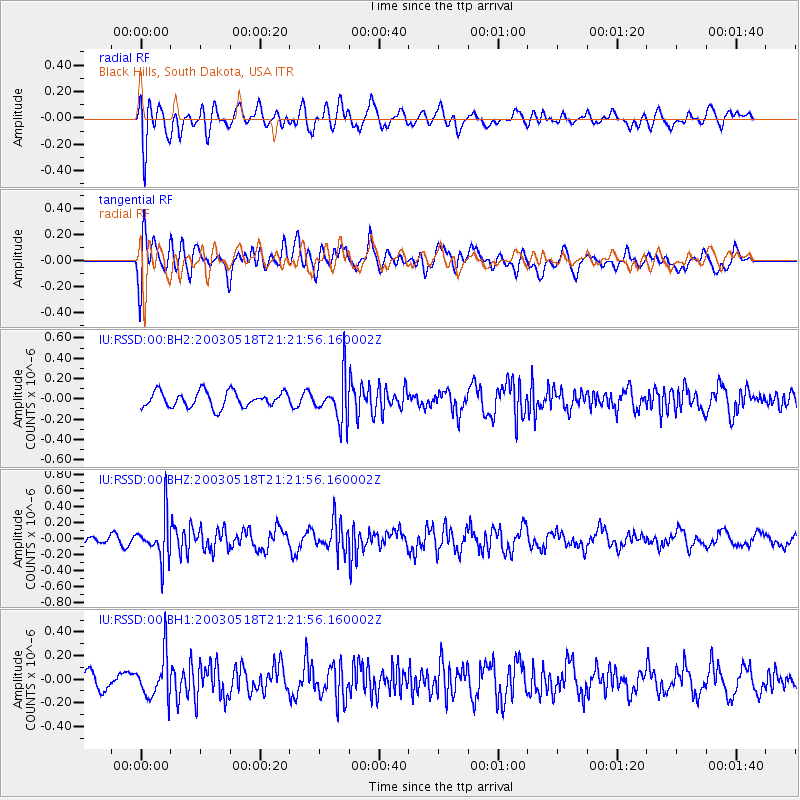
RSSD Black Hills, South Dakota, USA - Earthquake Result Viewer
*The percent match for this event was below the threshold and hence no stack was calculated.
| Earthquake location: |
San Juan Province, Argentina |
| Earthquake latitude/longitude: |
-31.4/-69.1 |
| Earthquake time(UTC): |
2003/05/18 (138) 21:10:21 GMT |
| Earthquake Depth: |
114 km |
| Earthquake Magnitude: |
5.5 MW, 5.5 MB |
| Earthquake Catalog/Contributor: |
NEIC PDE/NEIC PDE-M |
|
| Network: |
IU Global Seismograph Network (GSN - IRIS/USGS) |
| Station: |
RSSD Black Hills, South Dakota, USA |
| Lat/Lon: |
44.12 N/104.04 W |
| Elevation: |
2060 m |
|
| Distance: |
81.7 deg |
| Az: |
335.36 deg |
| Baz: |
150.329 deg |
| Ray Param: |
$rayparam |
*The percent match for this event was below the threshold and hence was not used in the summary stack. |
|
| Radial Match: |
58.82277 % |
| Radial Bump: |
400 |
| Transverse Match: |
61.182087 % |
| Transverse Bump: |
400 |
| SOD ConfigId: |
590571 |
| Insert Time: |
2013-09-25 02:03:22.585 +0000 |
| GWidth: |
2.5 |
| Max Bumps: |
400 |
| Tol: |
0.001 |
|
Signal To Noise
| Channel | StoN | STA | LTA |
| IU:RSSD:00:BHZ:20030518T21:21:56.160002Z | 4.5134263 | 2.672068E-7 | 5.9202645E-8 |
| IU:RSSD:00:BH1:20030518T21:21:56.160002Z | 2.7769403 | 1.8251853E-7 | 6.572648E-8 |
| IU:RSSD:00:BH2:20030518T21:21:56.160002Z | 2.7569833 | 2.1069556E-7 | 7.64225E-8 |
| Arrivals |
| Ps | |
| PpPs | |
| PsPs/PpSs | |


