You are here: Home > Network List > IU - Global Seismograph Network (GSN - IRIS/USGS) Stations List
> Station JOHN Johnston Island, USA > Earthquake Result Viewer
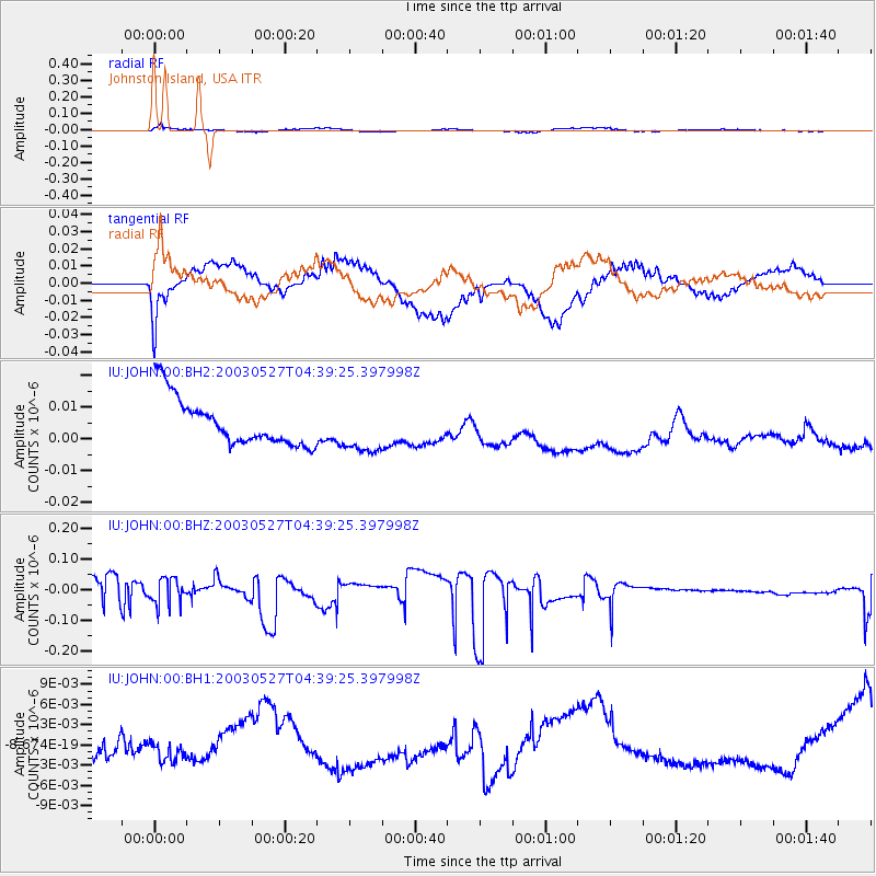
JOHN Johnston Island, USA - Earthquake Result Viewer
*The percent match for this event was below the threshold and hence no stack was calculated.
| Earthquake location: |
South Of Kermadec Islands |
| Earthquake latitude/longitude: |
-33.5/-179.5 |
| Earthquake time(UTC): |
2003/05/27 (147) 04:31:05 GMT |
| Earthquake Depth: |
100 km |
| Earthquake Magnitude: |
5.5 MW |
| Earthquake Catalog/Contributor: |
NEIC PDE/NEIC PDE-M |
|
| Network: |
IU Global Seismograph Network (GSN - IRIS/USGS) |
| Station: |
JOHN Johnston Island, USA |
| Lat/Lon: |
16.73 N/169.53 W |
| Elevation: |
2.0 m |
|
| Distance: |
50.8 deg |
| Az: |
12.407 deg |
| Baz: |
190.805 deg |
| Ray Param: |
$rayparam |
*The percent match for this event was below the threshold and hence was not used in the summary stack. |
|
| Radial Match: |
52.230988 % |
| Radial Bump: |
400 |
| Transverse Match: |
49.740402 % |
| Transverse Bump: |
400 |
| SOD ConfigId: |
590571 |
| Insert Time: |
2013-09-25 02:11:33.437 +0000 |
| GWidth: |
2.5 |
| Max Bumps: |
400 |
| Tol: |
0.001 |
|
Signal To Noise
| Channel | StoN | STA | LTA |
| IU:JOHN:00:BHZ:20030527T04:39:25.397998Z | 1.1312011 | 4.358043E-8 | 3.85258E-8 |
| IU:JOHN:00:BH1:20030527T04:39:25.397998Z | 0.8319154 | 1.9043054E-9 | 2.2890614E-9 |
| IU:JOHN:00:BH2:20030527T04:39:25.397998Z | 1.0257264 | 7.679067E-9 | 7.486467E-9 |
| Arrivals |
| Ps | |
| PpPs | |
| PsPs/PpSs | |


