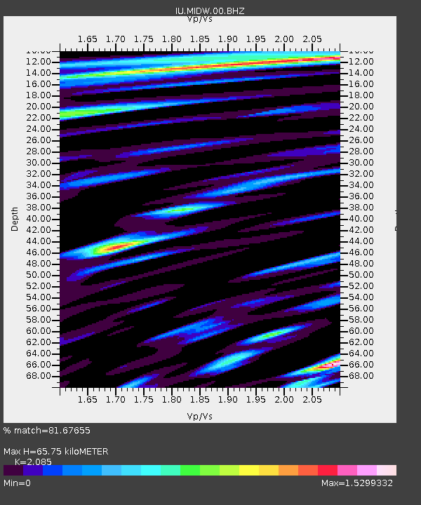
MIDW Midway Island, USA - Earthquake Result Viewer

Earthquake location: New Britain Region, P.N.G.
Earthquake latitude/longitude: -5.1/152.5
Earthquake time(UTC): 2003/06/07 (158) 00:32:45 GMT
Earthquake Depth: 33 km
Earthquake Magnitude: 6.0 MB, 6.8 MS, 6.6 MW, 6.5 MW
Earthquake Catalog/Contributor: WHDF/NEIC
Network: IU Global Seismograph Network (GSN - IRIS/USGS)
Station: MIDW Midway Island, USA
Lat/Lon: 28.22 N/177.37 W
Elevation: 18 m
Distance: 44.0 deg
Az: 39.58 deg
Baz: 225.986 deg
Ray Param: 0.07209473
Estimated Moho Depth: 65.75 km
Estimated Crust Vp/Vs: 2.09
Assumed Crust Vp: 4.24 km/s
Estimated Crust Vs: 2.034 km/s
Estimated Crust Poisson's Ratio: 0.35
Radial Match: 81.67655 %
Radial Bump: 327
Transverse Match: 73.862854 %
Transverse Bump: 400
SOD ConfigId: 590571
Insert Time: 2013-09-25 02:17:17.702 +0000
GWidth: 2.5
Max Bumps: 400
Tol: 0.001

Signal To Noise

ChannelStoNSTALTA
IU:MIDW:00:BHZ:20030607T00:40:19.67199Z10.3418373.72881E-63.6055584E-7
IU:MIDW:00:BH1:20030607T00:40:19.67199Z0.7224256.9017824E-79.553632E-7
IU:MIDW:00:BH2:20030607T00:40:19.67199Z3.6020741.8678945E-65.1856085E-7
Arrivals
Ps17 SECOND
PpPs47 SECOND
PsPs/PpSs64 SECOND