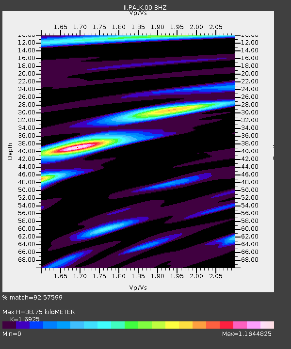
PALK Pallekele, Sri Lanka - Earthquake Result Viewer
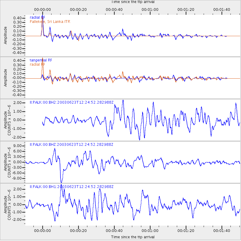
Earthquake location: Rat Islands, Aleutian Islands
Earthquake latitude/longitude: 51.4/176.8
Earthquake time(UTC): 2003/06/23 (174) 12:12:34 GMT
Earthquake Depth: 20 km
Earthquake Magnitude: 6.3 MB, 7.0 MS, 6.9 MW, 6.8 MW
Earthquake Catalog/Contributor: WHDF/NEIC
Network: II Global Seismograph Network (GSN - IRIS/IDA)
Station: PALK Pallekele, Sri Lanka
Lat/Lon: 7.27 N/80.70 E
Elevation: 460 m
Distance: 88.1 deg
Az: 279.251 deg
Baz: 38.514 deg
Ray Param: 0.04278435
Estimated Moho Depth: 38.75 km
Estimated Crust Vp/Vs: 1.69
Assumed Crust Vp: 6.545 km/s
Estimated Crust Vs: 3.867 km/s
Estimated Crust Poisson's Ratio: 0.23
Radial Match: 92.57599 %
Radial Bump: 400
Transverse Match: 79.558784 %
Transverse Bump: 400
SOD ConfigId: 590571
Insert Time: 2013-09-25 02:25:08.394 +0000
GWidth: 2.5
Max Bumps: 400
Tol: 0.001

Signal To Noise

ChannelStoNSTALTA
II:PALK:00:BHZ:20030623T12:24:52.282988Z3.65968549.519664E-72.6012248E-7
II:PALK:00:BH1:20030623T12:24:52.282988Z1.00575082.5101377E-72.4957848E-7
II:PALK:00:BH2:20030623T12:24:52.282988Z1.20524472.797775E-72.3213337E-7
Arrivals
Ps4.2 SECOND
PpPs16 SECOND
PsPs/PpSs20 SECOND