You are here: Home > Network List > II - Global Seismograph Network (GSN - IRIS/IDA) Stations List
> Station MBAR Mbarara, Uganda > Earthquake Result Viewer
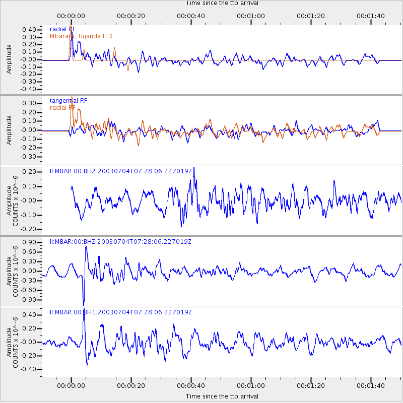
MBAR Mbarara, Uganda - Earthquake Result Viewer
*The percent match for this event was below the threshold and hence no stack was calculated.
| Earthquake location: |
Svalbard Region |
| Earthquake latitude/longitude: |
76.4/23.3 |
| Earthquake time(UTC): |
2003/07/04 (185) 07:16:44 GMT |
| Earthquake Depth: |
10 km |
| Earthquake Magnitude: |
5.7 MB, 5.1 MS, 5.5 MW, 5.4 MW |
| Earthquake Catalog/Contributor: |
WHDF/NEIC |
|
| Network: |
II Global Seismograph Network (GSN - IRIS/IDA) |
| Station: |
MBAR Mbarara, Uganda |
| Lat/Lon: |
0.60 S/30.74 E |
| Elevation: |
1390 m |
|
| Distance: |
77.0 deg |
| Az: |
172.347 deg |
| Baz: |
358.19 deg |
| Ray Param: |
$rayparam |
*The percent match for this event was below the threshold and hence was not used in the summary stack. |
|
| Radial Match: |
55.369316 % |
| Radial Bump: |
400 |
| Transverse Match: |
60.18219 % |
| Transverse Bump: |
400 |
| SOD ConfigId: |
590571 |
| Insert Time: |
2013-09-25 02:31:17.521 +0000 |
| GWidth: |
2.5 |
| Max Bumps: |
400 |
| Tol: |
0.001 |
|
Signal To Noise
| Channel | StoN | STA | LTA |
| II:MBAR:00:BHZ:20030704T07:28:06.227019Z | 5.0823708 | 3.4099887E-7 | 6.709445E-8 |
| II:MBAR:00:BH1:20030704T07:28:06.227019Z | 2.3570113 | 1.4904158E-7 | 6.323329E-8 |
| II:MBAR:00:BH2:20030704T07:28:06.227019Z | 1.2915442 | 6.81361E-8 | 5.275553E-8 |
| Arrivals |
| Ps | |
| PpPs | |
| PsPs/PpSs | |


