You are here: Home > Network List > IU - Global Seismograph Network (GSN - IRIS/USGS) Stations List
> Station JOHN Johnston Island, USA > Earthquake Result Viewer
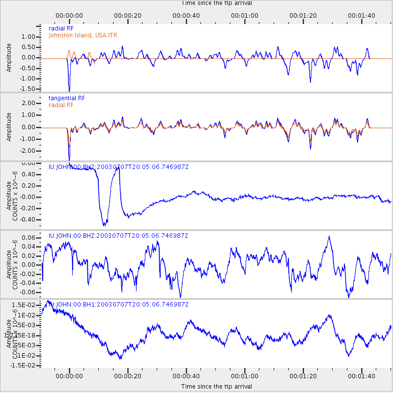
JOHN Johnston Island, USA - Earthquake Result Viewer
*The percent match for this event was below the threshold and hence no stack was calculated.
| Earthquake location: |
Philippine Islands Region |
| Earthquake latitude/longitude: |
20.4/122.0 |
| Earthquake time(UTC): |
2003/07/07 (188) 19:55:00 GMT |
| Earthquake Depth: |
10 km |
| Earthquake Magnitude: |
5.5 MW, 5.6 MW |
| Earthquake Catalog/Contributor: |
NEIC PDE/NEIC PDE-M |
|
| Network: |
IU Global Seismograph Network (GSN - IRIS/USGS) |
| Station: |
JOHN Johnston Island, USA |
| Lat/Lon: |
16.73 N/169.53 W |
| Elevation: |
2.0 m |
|
| Distance: |
64.6 deg |
| Az: |
80.649 deg |
| Baz: |
284.952 deg |
| Ray Param: |
$rayparam |
*The percent match for this event was below the threshold and hence was not used in the summary stack. |
|
| Radial Match: |
42.18111 % |
| Radial Bump: |
318 |
| Transverse Match: |
44.160255 % |
| Transverse Bump: |
314 |
| SOD ConfigId: |
590571 |
| Insert Time: |
2013-09-25 02:33:07.001 +0000 |
| GWidth: |
2.5 |
| Max Bumps: |
400 |
| Tol: |
0.001 |
|
Signal To Noise
| Channel | StoN | STA | LTA |
| IU:JOHN:00:BHZ:20030707T20:05:06.746987Z | 1.5429201 | 3.9319502E-8 | 2.5483823E-8 |
| IU:JOHN:00:BH1:20030707T20:05:06.746987Z | 1.0173773 | 1.5059232E-8 | 1.4802014E-8 |
| IU:JOHN:00:BH2:20030707T20:05:06.746987Z | 0.50318986 | 1.9537366E-7 | 3.8827028E-7 |
| Arrivals |
| Ps | |
| PpPs | |
| PsPs/PpSs | |


