You are here: Home > Network List > IU - Global Seismograph Network (GSN - IRIS/USGS) Stations List
> Station RSSD Black Hills, South Dakota, USA > Earthquake Result Viewer
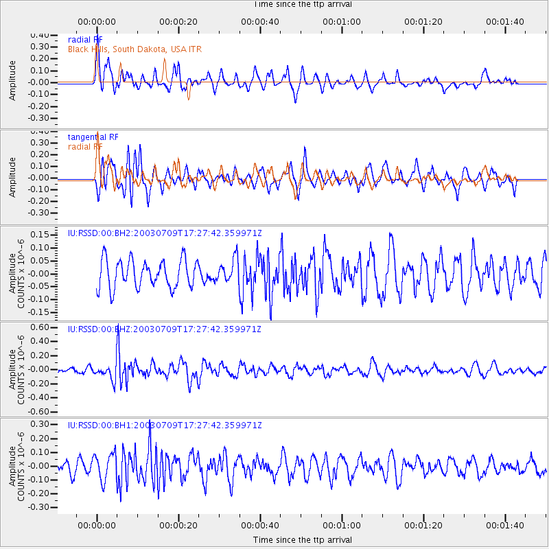
RSSD Black Hills, South Dakota, USA - Earthquake Result Viewer
*The percent match for this event was below the threshold and hence no stack was calculated.
| Earthquake location: |
Ryukyu Islands, Japan |
| Earthquake latitude/longitude: |
29.7/130.0 |
| Earthquake time(UTC): |
2003/07/09 (190) 17:15:14 GMT |
| Earthquake Depth: |
67 km |
| Earthquake Magnitude: |
5.5 MW, 5.5 MW |
| Earthquake Catalog/Contributor: |
NEIC PDE/NEIC PDE-M |
|
| Network: |
IU Global Seismograph Network (GSN - IRIS/USGS) |
| Station: |
RSSD Black Hills, South Dakota, USA |
| Lat/Lon: |
44.12 N/104.04 W |
| Elevation: |
2060 m |
|
| Distance: |
91.5 deg |
| Az: |
35.654 deg |
| Baz: |
315.258 deg |
| Ray Param: |
$rayparam |
*The percent match for this event was below the threshold and hence was not used in the summary stack. |
|
| Radial Match: |
56.075054 % |
| Radial Bump: |
400 |
| Transverse Match: |
64.98787 % |
| Transverse Bump: |
400 |
| SOD ConfigId: |
590571 |
| Insert Time: |
2013-09-25 02:34:11.706 +0000 |
| GWidth: |
2.5 |
| Max Bumps: |
400 |
| Tol: |
0.001 |
|
Signal To Noise
| Channel | StoN | STA | LTA |
| IU:RSSD:00:BHZ:20030709T17:27:42.359971Z | 1.855969 | 1.1861044E-7 | 6.390756E-8 |
| IU:RSSD:00:BH1:20030709T17:27:42.359971Z | 1.8051916 | 9.838745E-8 | 5.45025E-8 |
| IU:RSSD:00:BH2:20030709T17:27:42.359971Z | 0.83621234 | 4.534435E-8 | 5.4225882E-8 |
| Arrivals |
| Ps | |
| PpPs | |
| PsPs/PpSs | |


