You are here: Home > Network List > II - Global Seismograph Network (GSN - IRIS/IDA) Stations List
> Station MBAR Mbarara, Uganda > Earthquake Result Viewer
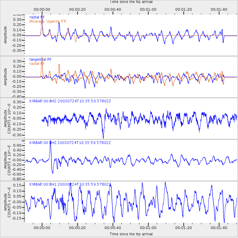
MBAR Mbarara, Uganda - Earthquake Result Viewer
*The percent match for this event was below the threshold and hence no stack was calculated.
| Earthquake location: |
Minahassa Peninsula, Sulawesi |
| Earthquake latitude/longitude: |
0.1/124.6 |
| Earthquake time(UTC): |
2003/07/24 (205) 10:23:21 GMT |
| Earthquake Depth: |
73 km |
| Earthquake Magnitude: |
5.8 MW, 5.7 MB, 5.8 MW |
| Earthquake Catalog/Contributor: |
NEIC PDE/NEIC PDE-M |
|
| Network: |
II Global Seismograph Network (GSN - IRIS/IDA) |
| Station: |
MBAR Mbarara, Uganda |
| Lat/Lon: |
0.60 S/30.74 E |
| Elevation: |
1390 m |
|
| Distance: |
93.8 deg |
| Az: |
269.41 deg |
| Baz: |
89.905 deg |
| Ray Param: |
$rayparam |
*The percent match for this event was below the threshold and hence was not used in the summary stack. |
|
| Radial Match: |
51.20372 % |
| Radial Bump: |
400 |
| Transverse Match: |
59.688885 % |
| Transverse Bump: |
400 |
| SOD ConfigId: |
590571 |
| Insert Time: |
2013-09-25 02:41:47.200 +0000 |
| GWidth: |
2.5 |
| Max Bumps: |
400 |
| Tol: |
0.001 |
|
Signal To Noise
| Channel | StoN | STA | LTA |
| II:MBAR:00:BHZ:20030724T10:35:59.57802Z | 4.2156796 | 2.3491165E-7 | 5.5723316E-8 |
| II:MBAR:00:BH1:20030724T10:35:59.57802Z | 1.1145794 | 5.1661353E-8 | 4.6350536E-8 |
| II:MBAR:00:BH2:20030724T10:35:59.57802Z | 2.7232902 | 1.1955508E-7 | 4.390097E-8 |
| Arrivals |
| Ps | |
| PpPs | |
| PsPs/PpSs | |


