You are here: Home > Network List > IU - Global Seismograph Network (GSN - IRIS/USGS) Stations List
> Station JOHN Johnston Island, USA > Earthquake Result Viewer
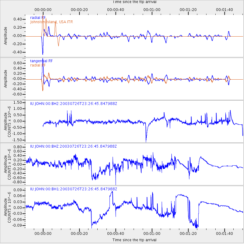
JOHN Johnston Island, USA - Earthquake Result Viewer
*The percent match for this event was below the threshold and hence no stack was calculated.
| Earthquake location: |
Vanuatu Islands |
| Earthquake latitude/longitude: |
-18.5/168.5 |
| Earthquake time(UTC): |
2003/07/26 (207) 23:19:35 GMT |
| Earthquake Depth: |
33 km |
| Earthquake Magnitude: |
5.5 MW |
| Earthquake Catalog/Contributor: |
NEIC PDE/NEIC PDE-M |
|
| Network: |
IU Global Seismograph Network (GSN - IRIS/USGS) |
| Station: |
JOHN Johnston Island, USA |
| Lat/Lon: |
16.73 N/169.53 W |
| Elevation: |
2.0 m |
|
| Distance: |
41.1 deg |
| Az: |
33.006 deg |
| Baz: |
212.653 deg |
| Ray Param: |
$rayparam |
*The percent match for this event was below the threshold and hence was not used in the summary stack. |
|
| Radial Match: |
56.637592 % |
| Radial Bump: |
400 |
| Transverse Match: |
58.387077 % |
| Transverse Bump: |
400 |
| SOD ConfigId: |
590571 |
| Insert Time: |
2013-09-25 02:45:40.435 +0000 |
| GWidth: |
2.5 |
| Max Bumps: |
400 |
| Tol: |
0.001 |
|
Signal To Noise
| Channel | StoN | STA | LTA |
| IU:JOHN:00:BHZ:20030726T23:26:45.847988Z | 0.8957109 | 2.6185467E-7 | 2.9234283E-7 |
| IU:JOHN:00:BH1:20030726T23:26:45.847988Z | 1.1430883 | 5.1943573E-8 | 4.5441432E-8 |
| IU:JOHN:00:BH2:20030726T23:26:45.847988Z | 0.41937688 | 6.2666025E-8 | 1.4942653E-7 |
| Arrivals |
| Ps | |
| PpPs | |
| PsPs/PpSs | |


