You are here: Home > Network List > IU - Global Seismograph Network (GSN - IRIS/USGS) Stations List
> Station JOHN Johnston Island, USA > Earthquake Result Viewer
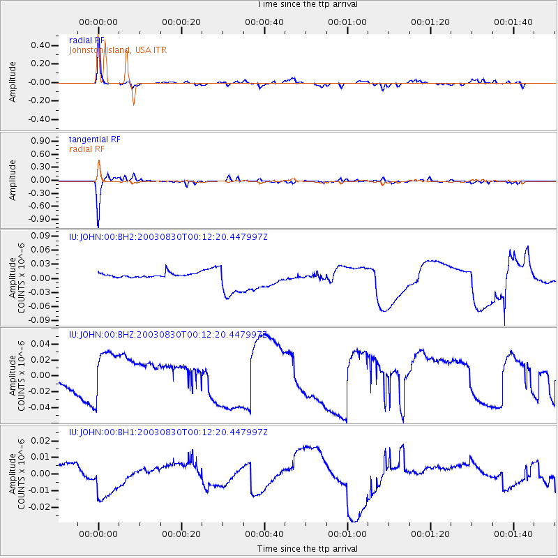
JOHN Johnston Island, USA - Earthquake Result Viewer

| Earthquake location: |
Vanuatu Islands |
| Earthquake latitude/longitude: |
-14.8/167.2 |
| Earthquake time(UTC): |
2003/08/30 (242) 00:05:39 GMT |
| Earthquake Depth: |
137 km |
| Earthquake Magnitude: |
6.0 MW, 6.0 MW |
| Earthquake Catalog/Contributor: |
NEIC PDE/NEIC PDE-M |
|
| Network: |
IU Global Seismograph Network (GSN - IRIS/USGS) |
| Station: |
JOHN Johnston Island, USA |
| Lat/Lon: |
16.73 N/169.53 W |
| Elevation: |
2.0 m |
|
| Distance: |
38.8 deg |
| Az: |
37.075 deg |
| Baz: |
217.486 deg |
| Ray Param: |
0.07485396 |
| Estimated Moho Depth: |
59.75 km |
| Estimated Crust Vp/Vs: |
2.10 |
| Assumed Crust Vp: |
4.24 km/s |
| Estimated Crust Vs: |
2.021 km/s |
| Estimated Crust Poisson's Ratio: |
0.35 |
|
| Radial Match: |
87.36524 % |
| Radial Bump: |
245 |
| Transverse Match: |
93.95741 % |
| Transverse Bump: |
209 |
| SOD ConfigId: |
590571 |
| Insert Time: |
2013-09-25 03:05:38.058 +0000 |
| GWidth: |
2.5 |
| Max Bumps: |
400 |
| Tol: |
0.001 |
|
Signal To Noise
| Channel | StoN | STA | LTA |
| IU:JOHN:00:BHZ:20030830T00:12:20.447997Z | 4.6914735 | 3.7147558E-8 | 7.918101E-9 |
| IU:JOHN:00:BH1:20030830T00:12:20.447997Z | 2.3975785 | 1.439122E-8 | 6.002398E-9 |
| IU:JOHN:00:BH2:20030830T00:12:20.447997Z | 8.55302 | 3.6840003E-8 | 4.307251E-9 |
| Arrivals |
| Ps | 16 SECOND |
| PpPs | 43 SECOND |
| PsPs/PpSs | 58 SECOND |


