You are here: Home > Network List > IU - Global Seismograph Network (GSN - IRIS/USGS) Stations List
> Station RSSD Black Hills, South Dakota, USA > Earthquake Result Viewer
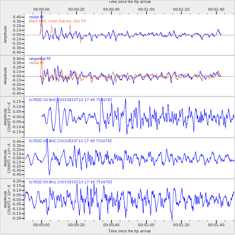
RSSD Black Hills, South Dakota, USA - Earthquake Result Viewer
*The percent match for this event was below the threshold and hence no stack was calculated.
| Earthquake location: |
Hokkaido, Japan Region |
| Earthquake latitude/longitude: |
41.9/142.6 |
| Earthquake time(UTC): |
2003/08/30 (242) 10:06:39 GMT |
| Earthquake Depth: |
52 km |
| Earthquake Magnitude: |
5.5 MW, 5.5 MW |
| Earthquake Catalog/Contributor: |
NEIC PDE/NEIC PDE-M |
|
| Network: |
IU Global Seismograph Network (GSN - IRIS/USGS) |
| Station: |
RSSD Black Hills, South Dakota, USA |
| Lat/Lon: |
44.12 N/104.04 W |
| Elevation: |
2060 m |
|
| Distance: |
75.7 deg |
| Az: |
43.011 deg |
| Baz: |
314.97 deg |
| Ray Param: |
$rayparam |
*The percent match for this event was below the threshold and hence was not used in the summary stack. |
|
| Radial Match: |
55.435783 % |
| Radial Bump: |
400 |
| Transverse Match: |
70.031494 % |
| Transverse Bump: |
400 |
| SOD ConfigId: |
590571 |
| Insert Time: |
2013-09-25 03:06:09.571 +0000 |
| GWidth: |
2.5 |
| Max Bumps: |
400 |
| Tol: |
0.001 |
|
Signal To Noise
| Channel | StoN | STA | LTA |
| IU:RSSD:00:BHZ:20030830T10:17:48.759978Z | 3.7709703 | 2.0317535E-7 | 5.3878797E-8 |
| IU:RSSD:00:BH1:20030830T10:17:48.759978Z | 1.2934728 | 6.32603E-8 | 4.890733E-8 |
| IU:RSSD:00:BH2:20030830T10:17:48.759978Z | 1.2611225 | 8.7255195E-8 | 6.9188516E-8 |
| Arrivals |
| Ps | |
| PpPs | |
| PsPs/PpSs | |


