You are here: Home > Network List > IU - Global Seismograph Network (GSN - IRIS/USGS) Stations List
> Station RSSD Black Hills, South Dakota, USA > Earthquake Result Viewer
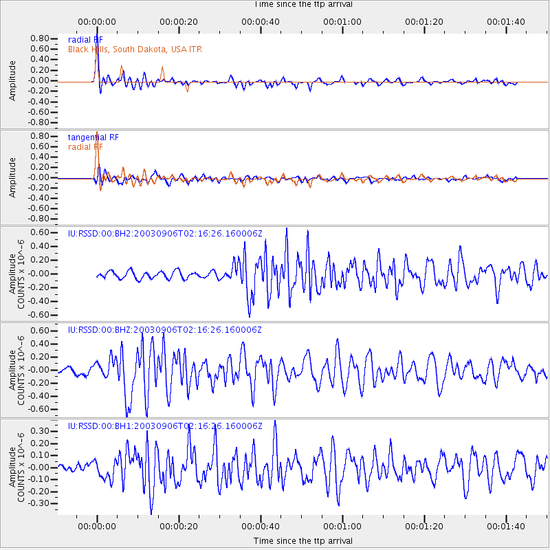
RSSD Black Hills, South Dakota, USA - Earthquake Result Viewer
*The percent match for this event was below the threshold and hence no stack was calculated.
| Earthquake location: |
Central East Pacific Rise |
| Earthquake latitude/longitude: |
-4.6/-106.0 |
| Earthquake time(UTC): |
2003/09/06 (249) 02:08:13 GMT |
| Earthquake Depth: |
10 km |
| Earthquake Magnitude: |
5.4 MB, 5.8 MS, 6.1 MW, 6.0 MW |
| Earthquake Catalog/Contributor: |
WHDF/NEIC |
|
| Network: |
IU Global Seismograph Network (GSN - IRIS/USGS) |
| Station: |
RSSD Black Hills, South Dakota, USA |
| Lat/Lon: |
44.12 N/104.04 W |
| Elevation: |
2060 m |
|
| Distance: |
48.6 deg |
| Az: |
1.93 deg |
| Baz: |
182.672 deg |
| Ray Param: |
$rayparam |
*The percent match for this event was below the threshold and hence was not used in the summary stack. |
|
| Radial Match: |
76.58039 % |
| Radial Bump: |
400 |
| Transverse Match: |
66.04075 % |
| Transverse Bump: |
400 |
| SOD ConfigId: |
590571 |
| Insert Time: |
2013-09-25 03:10:18.794 +0000 |
| GWidth: |
2.5 |
| Max Bumps: |
400 |
| Tol: |
0.001 |
|
Signal To Noise
| Channel | StoN | STA | LTA |
| IU:RSSD:00:BHZ:20030906T02:16:26.160006Z | 2.9742672 | 1.4332862E-7 | 4.8189552E-8 |
| IU:RSSD:00:BH1:20030906T02:16:26.160006Z | 1.270922 | 7.83216E-8 | 6.162582E-8 |
| IU:RSSD:00:BH2:20030906T02:16:26.160006Z | 2.1147032 | 1.08449925E-7 | 5.1283756E-8 |
| Arrivals |
| Ps | |
| PpPs | |
| PsPs/PpSs | |


