You are here: Home > Network List > IU - Global Seismograph Network (GSN - IRIS/USGS) Stations List
> Station POHA Pohakuloa, Hawaii, USA > Earthquake Result Viewer
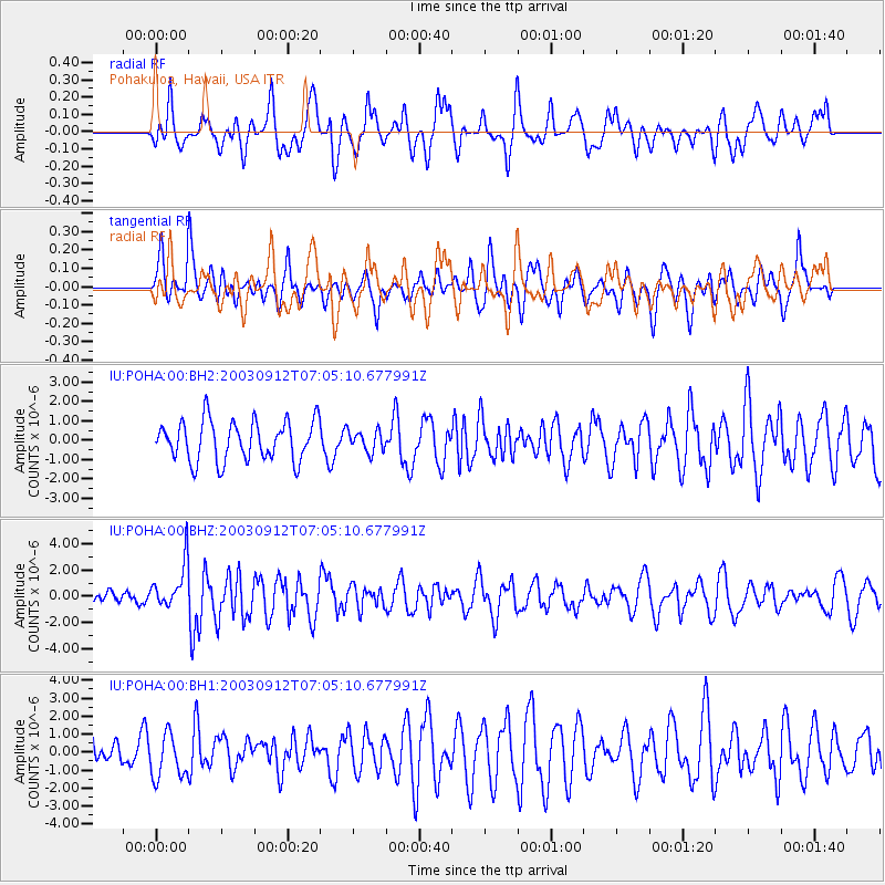
POHA Pohakuloa, Hawaii, USA - Earthquake Result Viewer
*The percent match for this event was below the threshold and hence no stack was calculated.
| Earthquake location: |
New Britain Region, P.N.G. |
| Earthquake latitude/longitude: |
-5.3/151.5 |
| Earthquake time(UTC): |
2003/09/12 (255) 06:55:55 GMT |
| Earthquake Depth: |
50 km |
| Earthquake Magnitude: |
6.0 MW, 5.6 MS, 5.8 MB, 6.0 MW |
| Earthquake Catalog/Contributor: |
NEIC PDE/NEIC PDE-M |
|
| Network: |
IU Global Seismograph Network (GSN - IRIS/USGS) |
| Station: |
POHA Pohakuloa, Hawaii, USA |
| Lat/Lon: |
19.76 N/155.53 W |
| Elevation: |
1967 m |
|
| Distance: |
57.7 deg |
| Az: |
62.799 deg |
| Baz: |
250.115 deg |
| Ray Param: |
$rayparam |
*The percent match for this event was below the threshold and hence was not used in the summary stack. |
|
| Radial Match: |
67.45944 % |
| Radial Bump: |
400 |
| Transverse Match: |
61.66937 % |
| Transverse Bump: |
400 |
| SOD ConfigId: |
590571 |
| Insert Time: |
2013-09-25 03:14:19.737 +0000 |
| GWidth: |
2.5 |
| Max Bumps: |
400 |
| Tol: |
0.001 |
|
Signal To Noise
| Channel | StoN | STA | LTA |
| IU:POHA:00:BHZ:20030912T07:05:10.677991Z | 1.6366566 | 1.746014E-6 | 1.0668176E-6 |
| IU:POHA:00:BH1:20030912T07:05:10.677991Z | 1.8627057 | 1.249651E-6 | 6.7087944E-7 |
| IU:POHA:00:BH2:20030912T07:05:10.677991Z | 0.52852136 | 5.4492017E-7 | 1.0310278E-6 |
| Arrivals |
| Ps | |
| PpPs | |
| PsPs/PpSs | |


