You are here: Home > Network List > IU - Global Seismograph Network (GSN - IRIS/USGS) Stations List
> Station JOHN Johnston Island, USA > Earthquake Result Viewer
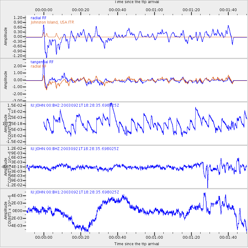
JOHN Johnston Island, USA - Earthquake Result Viewer
*The percent match for this event was below the threshold and hence no stack was calculated.
| Earthquake location: |
Myanmar |
| Earthquake latitude/longitude: |
19.9/95.7 |
| Earthquake time(UTC): |
2003/09/21 (264) 18:16:13 GMT |
| Earthquake Depth: |
10 km |
| Earthquake Magnitude: |
6.1 MB, 6.9 MS, 6.6 MW, 6.6 MW |
| Earthquake Catalog/Contributor: |
WHDF/NEIC |
|
| Network: |
IU Global Seismograph Network (GSN - IRIS/USGS) |
| Station: |
JOHN Johnston Island, USA |
| Lat/Lon: |
16.73 N/169.53 W |
| Elevation: |
2.0 m |
|
| Distance: |
88.8 deg |
| Az: |
72.756 deg |
| Baz: |
290.309 deg |
| Ray Param: |
$rayparam |
*The percent match for this event was below the threshold and hence was not used in the summary stack. |
|
| Radial Match: |
63.76493 % |
| Radial Bump: |
400 |
| Transverse Match: |
61.00443 % |
| Transverse Bump: |
370 |
| SOD ConfigId: |
590571 |
| Insert Time: |
2013-09-25 03:18:55.562 +0000 |
| GWidth: |
2.5 |
| Max Bumps: |
400 |
| Tol: |
0.001 |
|
Signal To Noise
| Channel | StoN | STA | LTA |
| IU:JOHN:00:BHZ:20030921T18:28:35.698025Z | 0.6815551 | 8.3542717E-10 | 1.2257662E-9 |
| IU:JOHN:00:BH1:20030921T18:28:35.698025Z | 0.6674486 | 1.6191881E-9 | 2.4259368E-9 |
| IU:JOHN:00:BH2:20030921T18:28:35.698025Z | 1.0034901 | 4.79252E-9 | 4.7758517E-9 |
| Arrivals |
| Ps | |
| PpPs | |
| PsPs/PpSs | |


