You are here: Home > Network List > IU - Global Seismograph Network (GSN - IRIS/USGS) Stations List
> Station RSSD Black Hills, South Dakota, USA > Earthquake Result Viewer
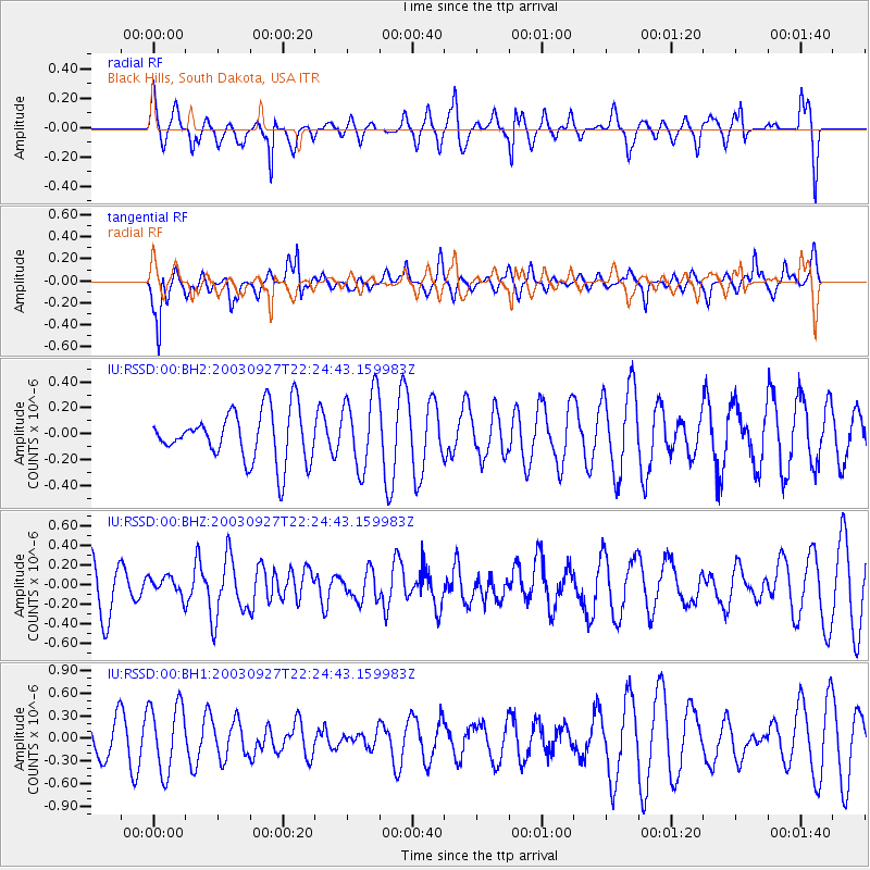
RSSD Black Hills, South Dakota, USA - Earthquake Result Viewer
*The percent match for this event was below the threshold and hence no stack was calculated.
| Earthquake location: |
Ryukyu Islands, Japan |
| Earthquake latitude/longitude: |
28.8/128.4 |
| Earthquake time(UTC): |
2003/09/27 (270) 22:12:01 GMT |
| Earthquake Depth: |
10 km |
| Earthquake Magnitude: |
5.7 MW |
| Earthquake Catalog/Contributor: |
NEIC PDE/NEIC PDE-M |
|
| Network: |
IU Global Seismograph Network (GSN - IRIS/USGS) |
| Station: |
RSSD Black Hills, South Dakota, USA |
| Lat/Lon: |
44.12 N/104.04 W |
| Elevation: |
2060 m |
|
| Distance: |
93.0 deg |
| Az: |
34.864 deg |
| Baz: |
315.859 deg |
| Ray Param: |
$rayparam |
*The percent match for this event was below the threshold and hence was not used in the summary stack. |
|
| Radial Match: |
72.64019 % |
| Radial Bump: |
400 |
| Transverse Match: |
84.479935 % |
| Transverse Bump: |
392 |
| SOD ConfigId: |
590571 |
| Insert Time: |
2013-09-25 03:26:33.154 +0000 |
| GWidth: |
2.5 |
| Max Bumps: |
400 |
| Tol: |
0.001 |
|
Signal To Noise
| Channel | StoN | STA | LTA |
| IU:RSSD:00:BHZ:20030927T22:24:43.159983Z | 0.35647565 | 9.608216E-8 | 2.695336E-7 |
| IU:RSSD:00:BH1:20030927T22:24:43.159983Z | 1.7151977 | 4.5212184E-7 | 2.635975E-7 |
| IU:RSSD:00:BH2:20030927T22:24:43.159983Z | 1.5046862 | 2.9343292E-7 | 1.9501269E-7 |
| Arrivals |
| Ps | |
| PpPs | |
| PsPs/PpSs | |


