You are here: Home > Network List > IU - Global Seismograph Network (GSN - IRIS/USGS) Stations List
> Station RSSD Black Hills, South Dakota, USA > Earthquake Result Viewer
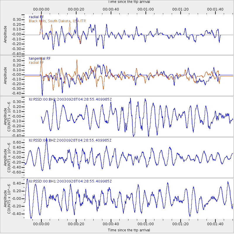
RSSD Black Hills, South Dakota, USA - Earthquake Result Viewer
*The percent match for this event was below the threshold and hence no stack was calculated.
| Earthquake location: |
Hokkaido, Japan Region |
| Earthquake latitude/longitude: |
42.6/144.7 |
| Earthquake time(UTC): |
2003/09/28 (271) 04:17:54 GMT |
| Earthquake Depth: |
33 km |
| Earthquake Magnitude: |
5.6 MW |
| Earthquake Catalog/Contributor: |
NEIC PDE/NEIC PDE-M |
|
| Network: |
IU Global Seismograph Network (GSN - IRIS/USGS) |
| Station: |
RSSD Black Hills, South Dakota, USA |
| Lat/Lon: |
44.12 N/104.04 W |
| Elevation: |
2060 m |
|
| Distance: |
74.0 deg |
| Az: |
44.287 deg |
| Baz: |
314.306 deg |
| Ray Param: |
$rayparam |
*The percent match for this event was below the threshold and hence was not used in the summary stack. |
|
| Radial Match: |
61.797073 % |
| Radial Bump: |
400 |
| Transverse Match: |
45.55351 % |
| Transverse Bump: |
400 |
| SOD ConfigId: |
590571 |
| Insert Time: |
2013-09-25 03:27:25.556 +0000 |
| GWidth: |
2.5 |
| Max Bumps: |
400 |
| Tol: |
0.001 |
|
Signal To Noise
| Channel | StoN | STA | LTA |
| IU:RSSD:00:BHZ:20030928T04:28:55.409985Z | 2.1855474 | 3.86161E-7 | 1.7668846E-7 |
| IU:RSSD:00:BH1:20030928T04:28:55.409985Z | 0.9227044 | 2.2903309E-7 | 2.4821935E-7 |
| IU:RSSD:00:BH2:20030928T04:28:55.409985Z | 1.0111456 | 1.4191373E-7 | 1.4034944E-7 |
| Arrivals |
| Ps | |
| PpPs | |
| PsPs/PpSs | |


