You are here: Home > Network List > IU - Global Seismograph Network (GSN - IRIS/USGS) Stations List
> Station RSSD Black Hills, South Dakota, USA > Earthquake Result Viewer
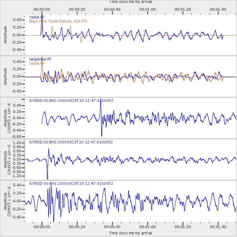
RSSD Black Hills, South Dakota, USA - Earthquake Result Viewer
*The percent match for this event was below the threshold and hence no stack was calculated.
| Earthquake location: |
Kuril Islands |
| Earthquake latitude/longitude: |
48.3/153.2 |
| Earthquake time(UTC): |
2003/09/29 (272) 16:02:46 GMT |
| Earthquake Depth: |
118 km |
| Earthquake Magnitude: |
5.5 MB |
| Earthquake Catalog/Contributor: |
NEIC PDE/NEIC PDE-M |
|
| Network: |
IU Global Seismograph Network (GSN - IRIS/USGS) |
| Station: |
RSSD Black Hills, South Dakota, USA |
| Lat/Lon: |
44.12 N/104.04 W |
| Elevation: |
2060 m |
|
| Distance: |
65.8 deg |
| Az: |
50.349 deg |
| Baz: |
314.43 deg |
| Ray Param: |
$rayparam |
*The percent match for this event was below the threshold and hence was not used in the summary stack. |
|
| Radial Match: |
68.65035 % |
| Radial Bump: |
400 |
| Transverse Match: |
50.89779 % |
| Transverse Bump: |
400 |
| SOD ConfigId: |
590571 |
| Insert Time: |
2013-09-25 03:29:06.224 +0000 |
| GWidth: |
2.5 |
| Max Bumps: |
400 |
| Tol: |
0.001 |
|
Signal To Noise
| Channel | StoN | STA | LTA |
| IU:RSSD:00:BHZ:20030929T16:12:47.910005Z | 5.0791388 | 4.0669016E-7 | 8.007069E-8 |
| IU:RSSD:00:BH1:20030929T16:12:47.910005Z | 2.2503538 | 1.4871776E-7 | 6.608639E-8 |
| IU:RSSD:00:BH2:20030929T16:12:47.910005Z | 2.4509335 | 2.2113966E-7 | 9.0226706E-8 |
| Arrivals |
| Ps | |
| PpPs | |
| PsPs/PpSs | |


