You are here: Home > Network List > IU - Global Seismograph Network (GSN - IRIS/USGS) Stations List
> Station POHA Pohakuloa, Hawaii, USA > Earthquake Result Viewer
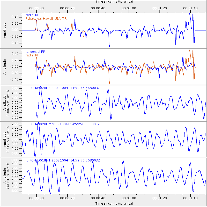
POHA Pohakuloa, Hawaii, USA - Earthquake Result Viewer
*The percent match for this event was below the threshold and hence no stack was calculated.
| Earthquake location: |
Banda Sea |
| Earthquake latitude/longitude: |
-7.1/125.4 |
| Earthquake time(UTC): |
2003/10/04 (277) 14:49:02 GMT |
| Earthquake Depth: |
533 km |
| Earthquake Magnitude: |
5.9 MW, 5.5 MB, 5.9 MW |
| Earthquake Catalog/Contributor: |
NEIC PDE/NEIC PDE-M |
|
| Network: |
IU Global Seismograph Network (GSN - IRIS/USGS) |
| Station: |
POHA Pohakuloa, Hawaii, USA |
| Lat/Lon: |
19.76 N/155.53 W |
| Elevation: |
1967 m |
|
| Distance: |
82.2 deg |
| Az: |
68.981 deg |
| Baz: |
259.641 deg |
| Ray Param: |
$rayparam |
*The percent match for this event was below the threshold and hence was not used in the summary stack. |
|
| Radial Match: |
56.690044 % |
| Radial Bump: |
400 |
| Transverse Match: |
54.17737 % |
| Transverse Bump: |
400 |
| SOD ConfigId: |
590571 |
| Insert Time: |
2013-09-25 03:33:46.623 +0000 |
| GWidth: |
2.5 |
| Max Bumps: |
400 |
| Tol: |
0.001 |
|
Signal To Noise
| Channel | StoN | STA | LTA |
| IU:POHA:00:BHZ:20031004T14:59:56.568003Z | 1.8503038 | 4.8087477E-6 | 2.5988963E-6 |
| IU:POHA:00:BH1:20031004T14:59:56.568003Z | 2.3500297 | 5.27019E-6 | 2.2426057E-6 |
| IU:POHA:00:BH2:20031004T14:59:56.568003Z | 1.2652882 | 3.4492564E-6 | 2.7260635E-6 |
| Arrivals |
| Ps | |
| PpPs | |
| PsPs/PpSs | |


