You are here: Home > Network List > IU - Global Seismograph Network (GSN - IRIS/USGS) Stations List
> Station JOHN Johnston Island, USA > Earthquake Result Viewer
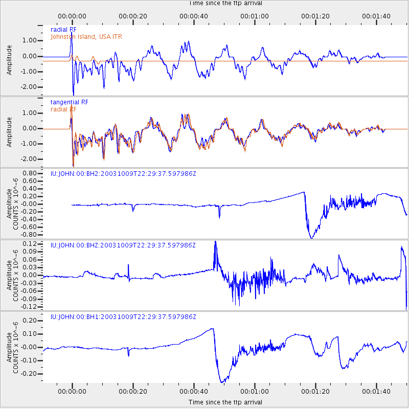
JOHN Johnston Island, USA - Earthquake Result Viewer
*The percent match for this event was below the threshold and hence no stack was calculated.
| Earthquake location: |
Philippine Islands Region |
| Earthquake latitude/longitude: |
13.8/119.9 |
| Earthquake time(UTC): |
2003/10/09 (282) 22:19:13 GMT |
| Earthquake Depth: |
33 km |
| Earthquake Magnitude: |
6.2 MW, 5.7 MS, 5.7 MB, 6.0 MW |
| Earthquake Catalog/Contributor: |
NEIC PDE/NEIC PDE-M |
|
| Network: |
IU Global Seismograph Network (GSN - IRIS/USGS) |
| Station: |
JOHN Johnston Island, USA |
| Lat/Lon: |
16.73 N/169.53 W |
| Elevation: |
2.0 m |
|
| Distance: |
67.8 deg |
| Az: |
77.361 deg |
| Baz: |
278.304 deg |
| Ray Param: |
$rayparam |
*The percent match for this event was below the threshold and hence was not used in the summary stack. |
|
| Radial Match: |
61.810066 % |
| Radial Bump: |
400 |
| Transverse Match: |
62.576458 % |
| Transverse Bump: |
400 |
| SOD ConfigId: |
590571 |
| Insert Time: |
2013-09-25 03:37:52.715 +0000 |
| GWidth: |
2.5 |
| Max Bumps: |
400 |
| Tol: |
0.001 |
|
Signal To Noise
| Channel | StoN | STA | LTA |
| IU:JOHN:00:BHZ:20031009T22:29:37.597986Z | 1.434609 | 8.021321E-9 | 5.5912945E-9 |
| IU:JOHN:00:BH1:20031009T22:29:37.597986Z | 1.7372693 | 1.0002859E-8 | 5.7578053E-9 |
| IU:JOHN:00:BH2:20031009T22:29:37.597986Z | 0.23780893 | 5.9677427E-9 | 2.5094696E-8 |
| Arrivals |
| Ps | |
| PpPs | |
| PsPs/PpSs | |


