You are here: Home > Network List > IU - Global Seismograph Network (GSN - IRIS/USGS) Stations List
> Station JOHN Johnston Island, USA > Earthquake Result Viewer
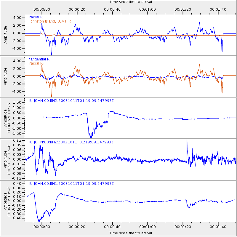
JOHN Johnston Island, USA - Earthquake Result Viewer
*The percent match for this event was below the threshold and hence no stack was calculated.
| Earthquake location: |
East Of Kuril Islands |
| Earthquake latitude/longitude: |
44.0/148.2 |
| Earthquake time(UTC): |
2003/10/11 (284) 01:11:31 GMT |
| Earthquake Depth: |
51 km |
| Earthquake Magnitude: |
5.7 MW, 5.5 MW, 6.2 MB |
| Earthquake Catalog/Contributor: |
NEIC PDE/NEIC PDE-M |
|
| Network: |
IU Global Seismograph Network (GSN - IRIS/USGS) |
| Station: |
JOHN Johnston Island, USA |
| Lat/Lon: |
16.73 N/169.53 W |
| Elevation: |
2.0 m |
|
| Distance: |
44.8 deg |
| Az: |
113.785 deg |
| Baz: |
316.41 deg |
| Ray Param: |
$rayparam |
*The percent match for this event was below the threshold and hence was not used in the summary stack. |
|
| Radial Match: |
44.26239 % |
| Radial Bump: |
316 |
| Transverse Match: |
45.40402 % |
| Transverse Bump: |
344 |
| SOD ConfigId: |
590571 |
| Insert Time: |
2013-09-25 03:38:48.665 +0000 |
| GWidth: |
2.5 |
| Max Bumps: |
400 |
| Tol: |
0.001 |
|
Signal To Noise
| Channel | StoN | STA | LTA |
| IU:JOHN:00:BHZ:20031011T01:19:09.247993Z | 4.063141 | 5.5325003E-8 | 1.3616314E-8 |
| IU:JOHN:00:BH1:20031011T01:19:09.247993Z | 8.049805 | 3.9815822E-7 | 4.9461846E-8 |
| IU:JOHN:00:BH2:20031011T01:19:09.247993Z | 7.913153 | 1.0273164E-6 | 1.298239E-7 |
| Arrivals |
| Ps | |
| PpPs | |
| PsPs/PpSs | |


