You are here: Home > Network List > TA - USArray Transportable Network (new EarthScope stations) Stations List
> Station P59A Jarrettsville, MD, USA > Earthquake Result Viewer
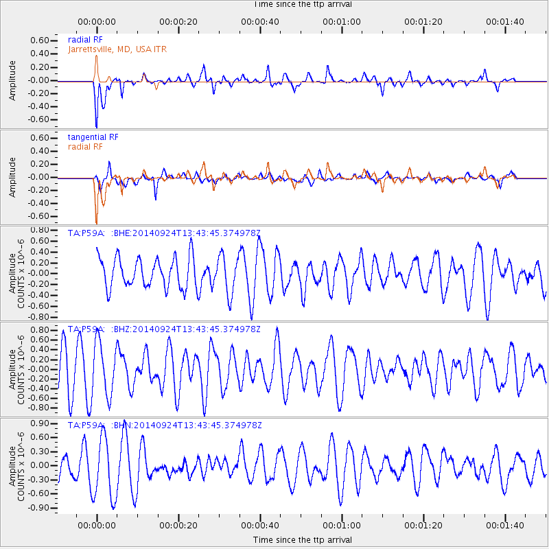
P59A Jarrettsville, MD, USA - Earthquake Result Viewer
*The percent match for this event was below the threshold and hence no stack was calculated.
| Earthquake location: |
Near East Coast Of Honshu, Japan |
| Earthquake latitude/longitude: |
37.6/141.4 |
| Earthquake time(UTC): |
2014/09/24 (267) 13:30:56 GMT |
| Earthquake Depth: |
52 km |
| Earthquake Magnitude: |
5.1 MW |
| Earthquake Catalog/Contributor: |
ISC/ISC |
|
| Network: |
TA USArray Transportable Network (new EarthScope stations) |
| Station: |
P59A Jarrettsville, MD, USA |
| Lat/Lon: |
39.61 N/76.43 W |
| Elevation: |
157 m |
|
| Distance: |
95.7 deg |
| Az: |
28.427 deg |
| Baz: |
330.675 deg |
| Ray Param: |
$rayparam |
*The percent match for this event was below the threshold and hence was not used in the summary stack. |
|
| Radial Match: |
58.63879 % |
| Radial Bump: |
400 |
| Transverse Match: |
66.26858 % |
| Transverse Bump: |
400 |
| SOD ConfigId: |
3390531 |
| Insert Time: |
2019-04-14 05:12:12.971 +0000 |
| GWidth: |
2.5 |
| Max Bumps: |
400 |
| Tol: |
0.001 |
|
Signal To Noise
| Channel | StoN | STA | LTA |
| TA:P59A: :BHZ:20140924T13:43:45.374978Z | 1.3038312 | 5.4177565E-7 | 4.1552593E-7 |
| TA:P59A: :BHN:20140924T13:43:45.374978Z | 2.0232468 | 6.566418E-7 | 3.2454855E-7 |
| TA:P59A: :BHE:20140924T13:43:45.374978Z | 1.3022606 | 3.5697227E-7 | 2.7411738E-7 |
| Arrivals |
| Ps | |
| PpPs | |
| PsPs/PpSs | |


