You are here: Home > Network List > IU - Global Seismograph Network (GSN - IRIS/USGS) Stations List
> Station POHA Pohakuloa, Hawaii, USA > Earthquake Result Viewer
POHA Pohakuloa, Hawaii, USA - Earthquake Result Viewer
*The percent match for this event was below the threshold and hence no stack was calculated.
| Earthquake location: |
W. Caroline Islands, Micronesia |
| Earthquake latitude/longitude: |
11.5/141.6 |
| Earthquake time(UTC): |
2003/10/23 (296) 07:53:52 GMT |
| Earthquake Depth: |
10 km |
| Earthquake Magnitude: |
5.5 MW, 5.6 MW |
| Earthquake Catalog/Contributor: |
NEIC PDE/NEIC PDE-M |
|
| Network: |
IU Global Seismograph Network (GSN - IRIS/USGS) |
| Station: |
POHA Pohakuloa, Hawaii, USA |
| Lat/Lon: |
19.76 N/155.53 W |
| Elevation: |
1967 m |
|
| Distance: |
60.8 deg |
| Az: |
73.747 deg |
| Baz: |
272.376 deg |
| Ray Param: |
$rayparam |
*The percent match for this event was below the threshold and hence was not used in the summary stack. |
|
| Radial Match: |
71.772766 % |
| Radial Bump: |
400 |
| Transverse Match: |
66.65837 % |
| Transverse Bump: |
400 |
| SOD ConfigId: |
590571 |
| Insert Time: |
2013-09-25 03:44:20.195 +0000 |
| GWidth: |
2.5 |
| Max Bumps: |
400 |
| Tol: |
0.001 |
|
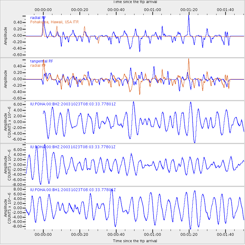
Signal To Noise
| Channel | StoN | STA | LTA |
| IU:POHA:00:BHZ:20031023T08:03:33.77801Z | 1.8571244 | 5.0828135E-6 | 2.7369267E-6 |
| IU:POHA:00:BH1:20031023T08:03:33.77801Z | 1.7712946 | 3.6566132E-6 | 2.0643731E-6 |
| IU:POHA:00:BH2:20031023T08:03:33.77801Z | 0.5247068 | 1.4800282E-6 | 2.8206769E-6 |
| Arrivals |
| Ps | |
| PpPs | |
| PsPs/PpSs | |


