You are here: Home > Network List > IU - Global Seismograph Network (GSN - IRIS/USGS) Stations List
> Station POHA Pohakuloa, Hawaii, USA > Earthquake Result Viewer
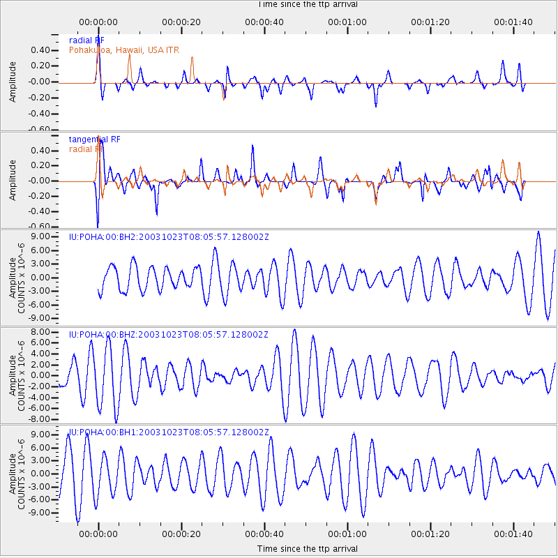
POHA Pohakuloa, Hawaii, USA - Earthquake Result Viewer
*The percent match for this event was below the threshold and hence no stack was calculated.
| Earthquake location: |
South Of Fiji Islands |
| Earthquake latitude/longitude: |
-23.7/179.8 |
| Earthquake time(UTC): |
2003/10/23 (296) 07:58:24 GMT |
| Earthquake Depth: |
504 km |
| Earthquake Magnitude: |
5.8 MW |
| Earthquake Catalog/Contributor: |
NEIC PDE/NEIC PDE-M |
|
| Network: |
IU Global Seismograph Network (GSN - IRIS/USGS) |
| Station: |
POHA Pohakuloa, Hawaii, USA |
| Lat/Lon: |
19.76 N/155.53 W |
| Elevation: |
1967 m |
|
| Distance: |
49.4 deg |
| Az: |
31.155 deg |
| Baz: |
210.231 deg |
| Ray Param: |
$rayparam |
*The percent match for this event was below the threshold and hence was not used in the summary stack. |
|
| Radial Match: |
52.256184 % |
| Radial Bump: |
267 |
| Transverse Match: |
58.04551 % |
| Transverse Bump: |
400 |
| SOD ConfigId: |
590571 |
| Insert Time: |
2013-09-25 03:44:39.720 +0000 |
| GWidth: |
2.5 |
| Max Bumps: |
400 |
| Tol: |
0.001 |
|
Signal To Noise
| Channel | StoN | STA | LTA |
| IU:POHA:00:BHZ:20031023T08:05:57.128002Z | 2.335044 | 5.566924E-6 | 2.3840769E-6 |
| IU:POHA:00:BH1:20031023T08:05:57.128002Z | 1.2843175 | 4.328452E-6 | 3.3702354E-6 |
| IU:POHA:00:BH2:20031023T08:05:57.128002Z | 1.312656 | 3.1872623E-6 | 2.4281014E-6 |
| Arrivals |
| Ps | |
| PpPs | |
| PsPs/PpSs | |


