
COCO West Island, Cocos (Keeling) Islands - Earthquake Result Viewer
| ||||||||||||||||||
| ||||||||||||||||||
| ||||||||||||||||||
|
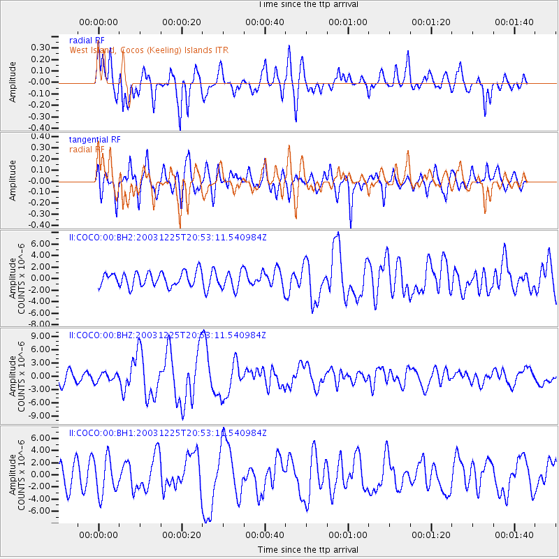
Signal To Noise
| Channel | StoN | STA | LTA |
| II:COCO:00:BHZ:20031225T20:53:11.540984Z | 0.79482365 | 9.188192E-7 | 1.1560038E-6 |
| II:COCO:00:BH1:20031225T20:53:11.540984Z | 2.0772672 | 2.985578E-6 | 1.4372625E-6 |
| II:COCO:00:BH2:20031225T20:53:11.540984Z | 1.3233696 | 1.6090441E-6 | 1.215869E-6 |
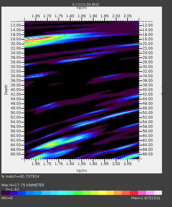
| Arrivals | |
| Ps | 2.6 SECOND |
| PpPs | 11 SECOND |
| PsPs/PpSs | 13 SECOND |

