EFI Mount Kent, East Falkland Island - Earthquake Result Viewer
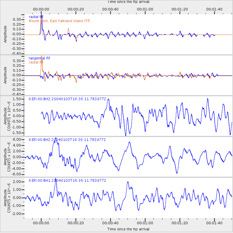
Earthquake location: Southeast Of Loyalty Islands
Earthquake latitude/longitude: -22.3/169.7
Earthquake time(UTC): 2004/01/03 (003) 16:23:21 GMT
Earthquake Depth: 22 km
Earthquake Magnitude: 6.4 MB, 7.1 MS, 7.1 MW, 6.8 MW
Earthquake Catalog/Contributor: WHDF/NEIC
Network: II Global Seismograph Network (GSN - IRIS/IDA)
Station: EFI Mount Kent, East Falkland Island
Lat/Lon: 51.68 S/58.06 W
Elevation: 110 m
Distance: 95.4 deg
Az: 152.425 deg
Baz: 223.528 deg
Ray Param: 0.040798187
Estimated Moho Depth: 38.25 km
Estimated Crust Vp/Vs: 1.75
Assumed Crust Vp: 6.472 km/s
Estimated Crust Vs: 3.704 km/s
Estimated Crust Poisson's Ratio: 0.26
Radial Match: 86.89559 %
Radial Bump: 400
Transverse Match: 60.992054 %
Transverse Bump: 400
SOD ConfigId: 590571
Insert Time: 2013-09-25 04:30:31.154 +0000
GWidth: 2.5
Max Bumps: 400
Tol: 0.001

Signal To Noise

ChannelStoNSTALTA
II:EFI:00:BHZ:20040103T16:36:11.783977Z5.3960752.1558646E-63.995246E-7
II:EFI:00:BH1:20040103T16:36:11.783977Z2.48927836.309481E-72.5346628E-7
II:EFI:00:BH2:20040103T16:36:11.783977Z2.32826475.192535E-72.2302167E-7
Arrivals
Ps4.5 SECOND
PpPs16 SECOND
PsPs/PpSs20 SECOND