You are here: Home > Network List > IU - Global Seismograph Network (GSN - IRIS/USGS) Stations List
> Station RSSD Black Hills, South Dakota, USA > Earthquake Result Viewer
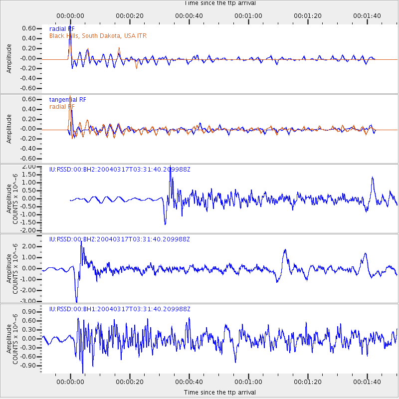
RSSD Black Hills, South Dakota, USA - Earthquake Result Viewer
*The percent match for this event was below the threshold and hence no stack was calculated.
| Earthquake location: |
Southern Bolivia |
| Earthquake latitude/longitude: |
-21.1/-65.6 |
| Earthquake time(UTC): |
2004/03/17 (077) 03:21:07 GMT |
| Earthquake Depth: |
290 km |
| Earthquake Magnitude: |
5.5 MB, 6.1 MW, 6.1 MW |
| Earthquake Catalog/Contributor: |
WHDF/NEIC |
|
| Network: |
IU Global Seismograph Network (GSN - IRIS/USGS) |
| Station: |
RSSD Black Hills, South Dakota, USA |
| Lat/Lon: |
44.12 N/104.04 W |
| Elevation: |
2060 m |
|
| Distance: |
73.9 deg |
| Az: |
332.209 deg |
| Baz: |
142.813 deg |
| Ray Param: |
$rayparam |
*The percent match for this event was below the threshold and hence was not used in the summary stack. |
|
| Radial Match: |
86.263664 % |
| Radial Bump: |
400 |
| Transverse Match: |
52.534092 % |
| Transverse Bump: |
400 |
| SOD ConfigId: |
590571 |
| Insert Time: |
2013-09-25 05:16:35.325 +0000 |
| GWidth: |
2.5 |
| Max Bumps: |
400 |
| Tol: |
0.001 |
|
Signal To Noise
| Channel | StoN | STA | LTA |
| IU:RSSD:00:BHZ:20040317T03:31:40.209988Z | 11.506218 | 1.3544294E-6 | 1.17712815E-7 |
| IU:RSSD:00:BH1:20040317T03:31:40.209988Z | 2.5490031 | 3.9614585E-7 | 1.5541207E-7 |
| IU:RSSD:00:BH2:20040317T03:31:40.209988Z | 7.959393 | 7.9301714E-7 | 9.9632864E-8 |
| Arrivals |
| Ps | |
| PpPs | |
| PsPs/PpSs | |


