You are here: Home > Network List > IU - Global Seismograph Network (GSN - IRIS/USGS) Stations List
> Station POHA Pohakuloa, Hawaii, USA > Earthquake Result Viewer
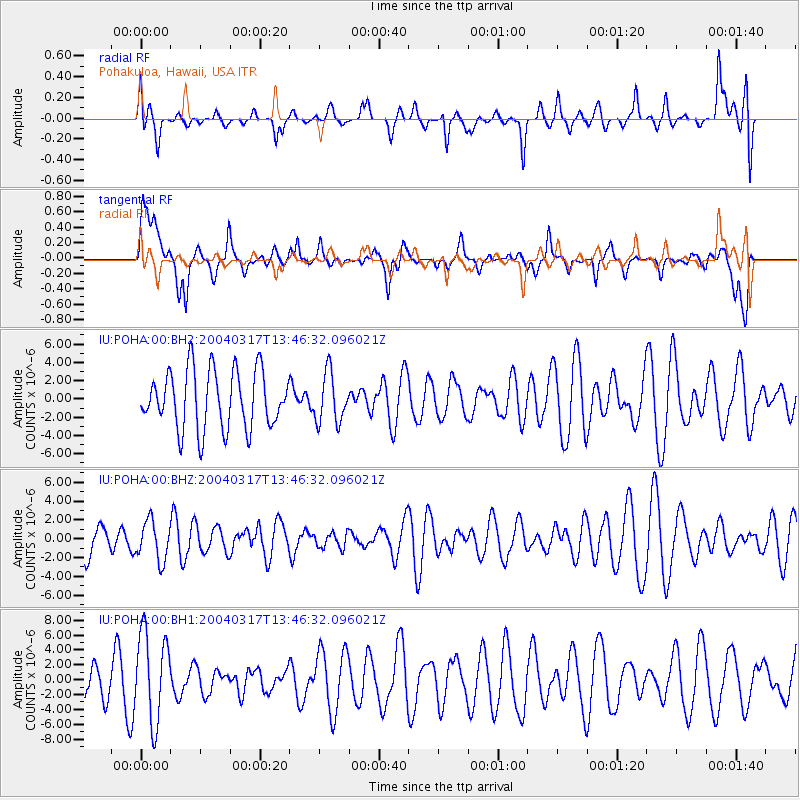
POHA Pohakuloa, Hawaii, USA - Earthquake Result Viewer
*The percent match for this event was below the threshold and hence no stack was calculated.
| Earthquake location: |
Kermadec Islands, New Zealand |
| Earthquake latitude/longitude: |
-30.3/-178.1 |
| Earthquake time(UTC): |
2004/03/17 (077) 13:37:42 GMT |
| Earthquake Depth: |
56 km |
| Earthquake Magnitude: |
5.5 MW |
| Earthquake Catalog/Contributor: |
NEIC PDE/NEIC PDE-M |
|
| Network: |
IU Global Seismograph Network (GSN - IRIS/USGS) |
| Station: |
POHA Pohakuloa, Hawaii, USA |
| Lat/Lon: |
19.76 N/155.53 W |
| Elevation: |
1967 m |
|
| Distance: |
54.3 deg |
| Az: |
26.404 deg |
| Baz: |
204.096 deg |
| Ray Param: |
$rayparam |
*The percent match for this event was below the threshold and hence was not used in the summary stack. |
|
| Radial Match: |
42.07092 % |
| Radial Bump: |
371 |
| Transverse Match: |
59.86753 % |
| Transverse Bump: |
400 |
| SOD ConfigId: |
590571 |
| Insert Time: |
2013-09-25 05:17:42.591 +0000 |
| GWidth: |
2.5 |
| Max Bumps: |
400 |
| Tol: |
0.001 |
|
Signal To Noise
| Channel | StoN | STA | LTA |
| IU:POHA:00:BHZ:20040317T13:46:32.096021Z | 1.0724851 | 2.0880202E-6 | 1.946899E-6 |
| IU:POHA:00:BH1:20040317T13:46:32.096021Z | 2.6335402 | 6.054173E-6 | 2.2988725E-6 |
| IU:POHA:00:BH2:20040317T13:46:32.096021Z | 0.8453893 | 2.6976327E-6 | 3.1909947E-6 |
| Arrivals |
| Ps | |
| PpPs | |
| PsPs/PpSs | |


