You are here: Home > Network List > IU - Global Seismograph Network (GSN - IRIS/USGS) Stations List
> Station RSSD Black Hills, South Dakota, USA > Earthquake Result Viewer
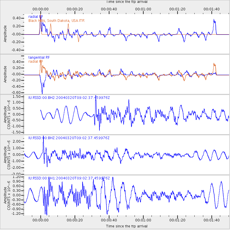
RSSD Black Hills, South Dakota, USA - Earthquake Result Viewer
*The percent match for this event was below the threshold and hence no stack was calculated.
| Earthquake location: |
Near East Coast Of Kamchatka |
| Earthquake latitude/longitude: |
53.8/160.5 |
| Earthquake time(UTC): |
2004/03/20 (080) 08:53:15 GMT |
| Earthquake Depth: |
52 km |
| Earthquake Magnitude: |
5.6 MW, 5.5 MW, 5.8 MB |
| Earthquake Catalog/Contributor: |
NEIC PDE/NEIC PDE-M |
|
| Network: |
IU Global Seismograph Network (GSN - IRIS/USGS) |
| Station: |
RSSD Black Hills, South Dakota, USA |
| Lat/Lon: |
44.12 N/104.04 W |
| Elevation: |
2060 m |
|
| Distance: |
58.8 deg |
| Az: |
56.931 deg |
| Baz: |
316.391 deg |
| Ray Param: |
$rayparam |
*The percent match for this event was below the threshold and hence was not used in the summary stack. |
|
| Radial Match: |
69.80085 % |
| Radial Bump: |
400 |
| Transverse Match: |
79.36034 % |
| Transverse Bump: |
334 |
| SOD ConfigId: |
590571 |
| Insert Time: |
2013-09-25 05:19:51.614 +0000 |
| GWidth: |
2.5 |
| Max Bumps: |
400 |
| Tol: |
0.001 |
|
Signal To Noise
| Channel | StoN | STA | LTA |
| IU:RSSD:00:BHZ:20040320T09:02:37.459976Z | 3.680448 | 9.18083E-7 | 2.494487E-7 |
| IU:RSSD:00:BH1:20040320T09:02:37.459976Z | 1.2364602 | 5.725183E-7 | 4.6303006E-7 |
| IU:RSSD:00:BH2:20040320T09:02:37.459976Z | 1.3615803 | 5.4348766E-7 | 3.9915946E-7 |
| Arrivals |
| Ps | |
| PpPs | |
| PsPs/PpSs | |


