WHY Whitehorse, YT - Earthquake Result Viewer
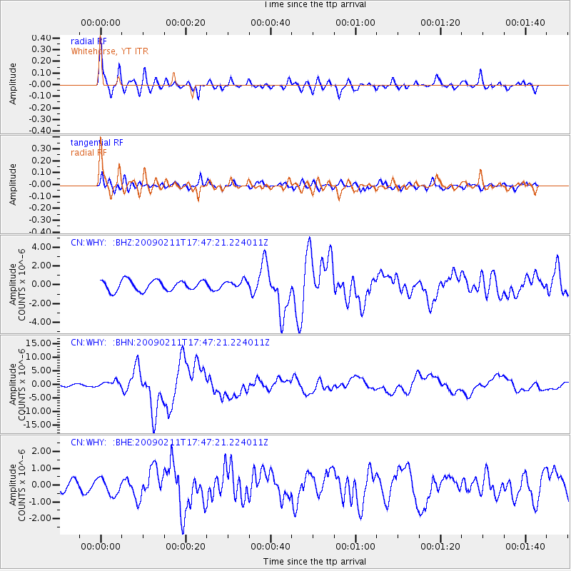
Earthquake location: Talaud Islands, Indonesia
Earthquake latitude/longitude: 3.9/126.4
Earthquake time(UTC): 2009/02/11 (042) 17:34:50 GMT
Earthquake Depth: 22 km
Earthquake Magnitude: 6.6 MB, 7.2 MS, 7.2 MW, 7.1 MW
Earthquake Catalog/Contributor: WHDF/NEIC
Network: CN Canadian National Seismograph Network
Station: WHY Whitehorse, YT
Lat/Lon: 60.66 N/134.88 W
Elevation: 1292 m
Distance: 90.9 deg
Az: 29.135 deg
Baz: 279.488 deg
Ray Param: 0.04163743
Estimated Moho Depth: 11.25 km
Estimated Crust Vp/Vs: 1.68
Assumed Crust Vp: 6.419 km/s
Estimated Crust Vs: 3.815 km/s
Estimated Crust Poisson's Ratio: 0.23
Radial Match: 92.816505 %
Radial Bump: 400
Transverse Match: 83.21932 %
Transverse Bump: 400
SOD ConfigId: 2658
Insert Time: 2010-02-27 07:44:19.202 +0000
GWidth: 2.5
Max Bumps: 400
Tol: 0.001

Signal To Noise

ChannelStoNSTALTA
CN:WHY: :BHN:20090211T17:47:21.224011Z4.07315971.1318043E-62.7786888E-7
CN:WHY: :BHE:20090211T17:47:21.224011Z2.09896874.9029603E-72.33589E-7
CN:WHY: :BHZ:20090211T17:47:21.224011Z0.75799054.176407E-75.5098405E-7
Arrivals
Ps1.2 SECOND
PpPs4.6 SECOND
PsPs/PpSs5.8 SECOND