You are here: Home > Network List > IU - Global Seismograph Network (GSN - IRIS/USGS) Stations List
> Station RSSD Black Hills, South Dakota, USA > Earthquake Result Viewer
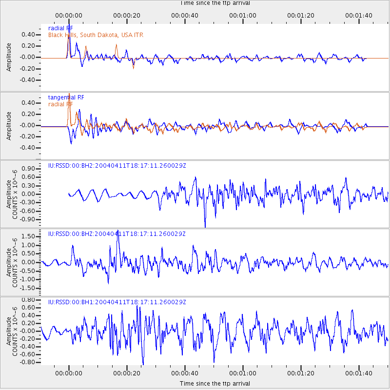
RSSD Black Hills, South Dakota, USA - Earthquake Result Viewer
*The percent match for this event was below the threshold and hence no stack was calculated.
| Earthquake location: |
Hokkaido, Japan Region |
| Earthquake latitude/longitude: |
42.9/144.8 |
| Earthquake time(UTC): |
2004/04/11 (102) 18:06:12 GMT |
| Earthquake Depth: |
42 km |
| Earthquake Magnitude: |
5.7 MB, 5.7 MS, 6.1 MW, 6.1 MW |
| Earthquake Catalog/Contributor: |
WHDF/NEIC |
|
| Network: |
IU Global Seismograph Network (GSN - IRIS/USGS) |
| Station: |
RSSD Black Hills, South Dakota, USA |
| Lat/Lon: |
44.12 N/104.04 W |
| Elevation: |
2060 m |
|
| Distance: |
73.7 deg |
| Az: |
44.41 deg |
| Baz: |
314.457 deg |
| Ray Param: |
$rayparam |
*The percent match for this event was below the threshold and hence was not used in the summary stack. |
|
| Radial Match: |
68.31103 % |
| Radial Bump: |
400 |
| Transverse Match: |
70.49095 % |
| Transverse Bump: |
400 |
| SOD ConfigId: |
590571 |
| Insert Time: |
2013-09-25 05:33:51.664 +0000 |
| GWidth: |
2.5 |
| Max Bumps: |
400 |
| Tol: |
0.001 |
|
Signal To Noise
| Channel | StoN | STA | LTA |
| IU:RSSD:00:BHZ:20040411T18:17:11.260029Z | 1.495671 | 3.5181267E-7 | 2.3522061E-7 |
| IU:RSSD:00:BH1:20040411T18:17:11.260029Z | 0.5284469 | 1.2403403E-7 | 2.3471425E-7 |
| IU:RSSD:00:BH2:20040411T18:17:11.260029Z | 1.8925664 | 1.9757009E-7 | 1.04392676E-7 |
| Arrivals |
| Ps | |
| PpPs | |
| PsPs/PpSs | |


