You are here: Home > Network List > IU - Global Seismograph Network (GSN - IRIS/USGS) Stations List
> Station RSSD Black Hills, South Dakota, USA > Earthquake Result Viewer
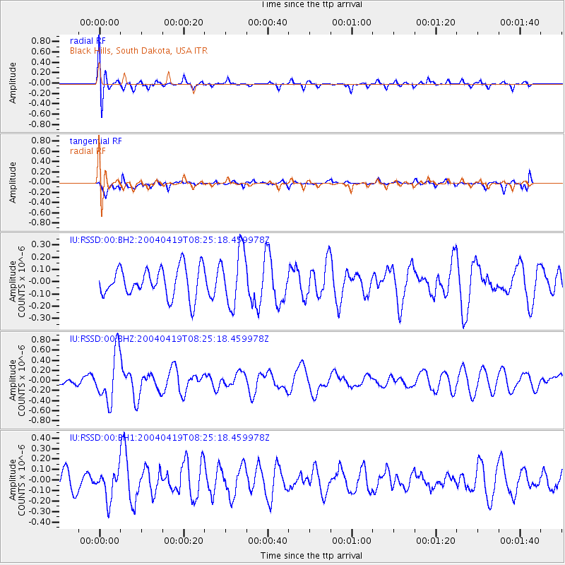
RSSD Black Hills, South Dakota, USA - Earthquake Result Viewer
*The percent match for this event was below the threshold and hence no stack was calculated.
| Earthquake location: |
Central Mid-Atlantic Ridge |
| Earthquake latitude/longitude: |
3.6/-32.2 |
| Earthquake time(UTC): |
2004/04/19 (110) 08:14:11 GMT |
| Earthquake Depth: |
10 km |
| Earthquake Magnitude: |
5.6 MW, 5.5 MB, 5.6 MW |
| Earthquake Catalog/Contributor: |
NEIC PDE/NEIC PDE-M |
|
| Network: |
IU Global Seismograph Network (GSN - IRIS/USGS) |
| Station: |
RSSD Black Hills, South Dakota, USA |
| Lat/Lon: |
44.12 N/104.04 W |
| Elevation: |
2060 m |
|
| Distance: |
74.5 deg |
| Az: |
314.753 deg |
| Baz: |
100.232 deg |
| Ray Param: |
$rayparam |
*The percent match for this event was below the threshold and hence was not used in the summary stack. |
|
| Radial Match: |
51.901627 % |
| Radial Bump: |
400 |
| Transverse Match: |
57.785454 % |
| Transverse Bump: |
400 |
| SOD ConfigId: |
590571 |
| Insert Time: |
2013-09-25 05:42:37.832 +0000 |
| GWidth: |
2.5 |
| Max Bumps: |
400 |
| Tol: |
0.001 |
|
Signal To Noise
| Channel | StoN | STA | LTA |
| IU:RSSD:00:BHZ:20040419T08:25:18.459978Z | 5.717269 | 4.991204E-7 | 8.730049E-8 |
| IU:RSSD:00:BH1:20040419T08:25:18.459978Z | 1.0741166 | 1.4291705E-7 | 1.3305542E-7 |
| IU:RSSD:00:BH2:20040419T08:25:18.459978Z | 1.9242723 | 2.2947056E-7 | 1.1925057E-7 |
| Arrivals |
| Ps | |
| PpPs | |
| PsPs/PpSs | |


