You are here: Home > Network List > IU - Global Seismograph Network (GSN - IRIS/USGS) Stations List
> Station POHA Pohakuloa, Hawaii, USA > Earthquake Result Viewer
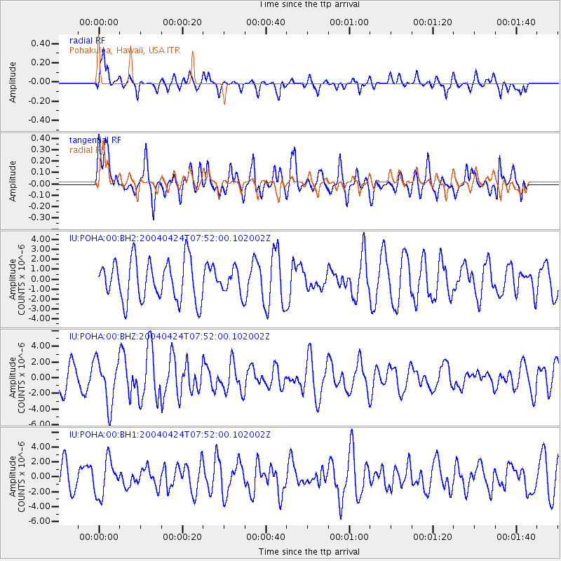
POHA Pohakuloa, Hawaii, USA - Earthquake Result Viewer
*The percent match for this event was below the threshold and hence no stack was calculated.
| Earthquake location: |
Tonga Islands |
| Earthquake latitude/longitude: |
-21.9/-174.8 |
| Earthquake time(UTC): |
2004/04/24 (115) 07:44:11 GMT |
| Earthquake Depth: |
8.0 km |
| Earthquake Magnitude: |
5.8 MB, 5.9 MS, 6.1 MW, 5.7 MW |
| Earthquake Catalog/Contributor: |
WHDF/NEIC |
|
| Network: |
IU Global Seismograph Network (GSN - IRIS/USGS) |
| Station: |
POHA Pohakuloa, Hawaii, USA |
| Lat/Lon: |
19.76 N/155.53 W |
| Elevation: |
1967 m |
|
| Distance: |
45.5 deg |
| Az: |
25.866 deg |
| Baz: |
205.479 deg |
| Ray Param: |
$rayparam |
*The percent match for this event was below the threshold and hence was not used in the summary stack. |
|
| Radial Match: |
38.700462 % |
| Radial Bump: |
393 |
| Transverse Match: |
51.745117 % |
| Transverse Bump: |
400 |
| SOD ConfigId: |
590571 |
| Insert Time: |
2013-09-25 05:45:05.765 +0000 |
| GWidth: |
2.5 |
| Max Bumps: |
400 |
| Tol: |
0.001 |
|
Signal To Noise
| Channel | StoN | STA | LTA |
| IU:POHA:00:BHZ:20040424T07:52:00.102002Z | 2.172142 | 2.9025666E-6 | 1.3362693E-6 |
| IU:POHA:00:BH1:20040424T07:52:00.102002Z | 1.431967 | 2.4541841E-6 | 1.7138552E-6 |
| IU:POHA:00:BH2:20040424T07:52:00.102002Z | 0.613591 | 1.2502494E-6 | 2.037594E-6 |
| Arrivals |
| Ps | |
| PpPs | |
| PsPs/PpSs | |


