
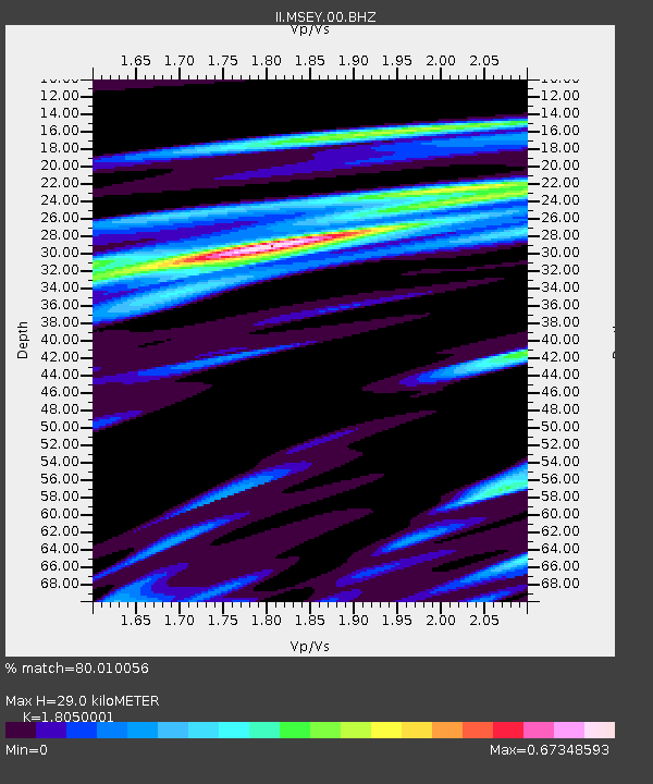
MSEY Mahe, Seychelles - Earthquake Result Viewer
| ||||||||||||||||||
| ||||||||||||||||||
| ||||||||||||||||||
|
Signal To Noise
| Channel | StoN | STA | LTA |
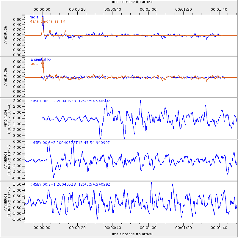
| II:MSEY:00:BHZ:20040528T12:45:54.94099Z | 9.283176 | 2.5054135E-6 | 2.6988752E-7 |
| II:MSEY:00:BH1:20040528T12:45:54.94099Z | 2.0707953 | 4.4913938E-7 | 2.168922E-7 |
| II:MSEY:00:BH2:20040528T12:45:54.94099Z | 6.012441 | 1.4790867E-6 | 2.4600436E-7 |
| Arrivals | |
| Ps | 4.0 SECOND |
| PpPs | 12 SECOND |
| PsPs/PpSs | 16 SECOND |

