You are here: Home > Network List > IU - Global Seismograph Network (GSN - IRIS/USGS) Stations List
> Station RSSD Black Hills, South Dakota, USA > Earthquake Result Viewer
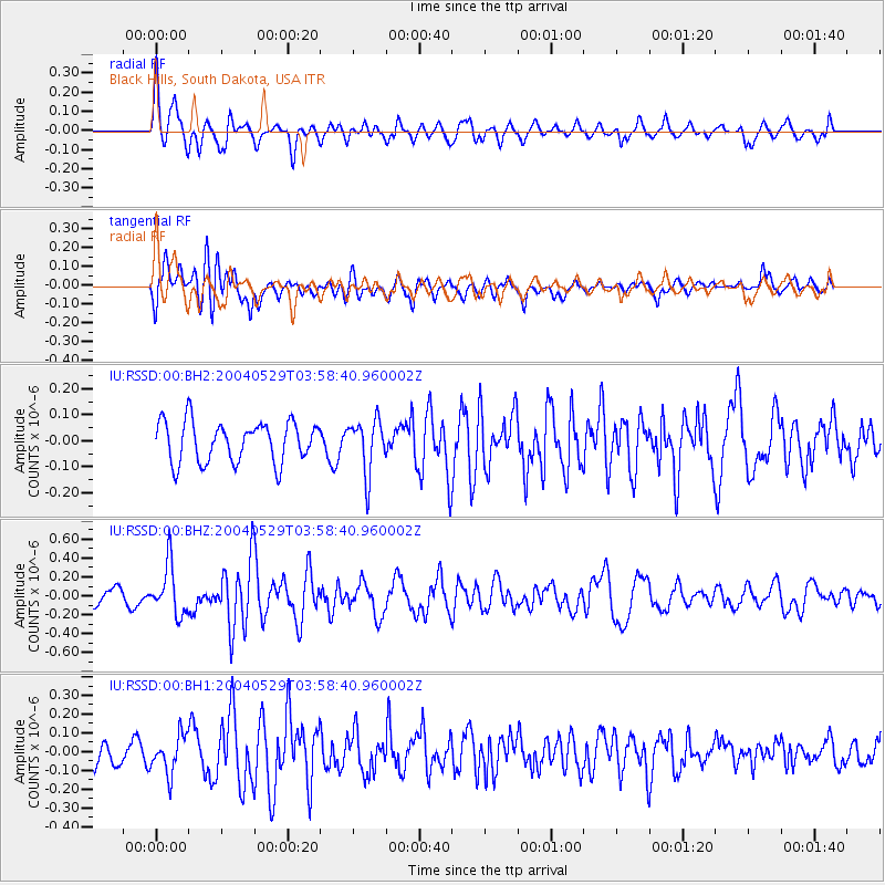
RSSD Black Hills, South Dakota, USA - Earthquake Result Viewer
*The percent match for this event was below the threshold and hence no stack was calculated.
| Earthquake location: |
Near East Coast Of Honshu, Japan |
| Earthquake latitude/longitude: |
37.8/141.9 |
| Earthquake time(UTC): |
2004/05/29 (150) 03:47:10 GMT |
| Earthquake Depth: |
29 km |
| Earthquake Magnitude: |
5.7 MW, 5.7 MB, 5.8 MW |
| Earthquake Catalog/Contributor: |
NEIC PDE/NEIC PDE-M |
|
| Network: |
IU Global Seismograph Network (GSN - IRIS/USGS) |
| Station: |
RSSD Black Hills, South Dakota, USA |
| Lat/Lon: |
44.12 N/104.04 W |
| Elevation: |
2060 m |
|
| Distance: |
79.0 deg |
| Az: |
42.046 deg |
| Baz: |
312.516 deg |
| Ray Param: |
$rayparam |
*The percent match for this event was below the threshold and hence was not used in the summary stack. |
|
| Radial Match: |
65.20436 % |
| Radial Bump: |
400 |
| Transverse Match: |
57.21953 % |
| Transverse Bump: |
400 |
| SOD ConfigId: |
590571 |
| Insert Time: |
2013-09-25 06:04:45.248 +0000 |
| GWidth: |
2.5 |
| Max Bumps: |
400 |
| Tol: |
0.001 |
|
Signal To Noise
| Channel | StoN | STA | LTA |
| IU:RSSD:00:BHZ:20040529T03:58:40.960002Z | 3.454267 | 2.647459E-7 | 7.664315E-8 |
| IU:RSSD:00:BH1:20040529T03:58:40.960002Z | 1.7385982 | 1.0095745E-7 | 5.8068302E-8 |
| IU:RSSD:00:BH2:20040529T03:58:40.960002Z | 1.3191342 | 1.02185005E-7 | 7.7463696E-8 |
| Arrivals |
| Ps | |
| PpPs | |
| PsPs/PpSs | |


