You are here: Home > Network List > CI - Caltech Regional Seismic Network Stations List
> Station LRL Laurel Mtn Radio Fac, Ridgecrest, CA, USA > Earthquake Result Viewer
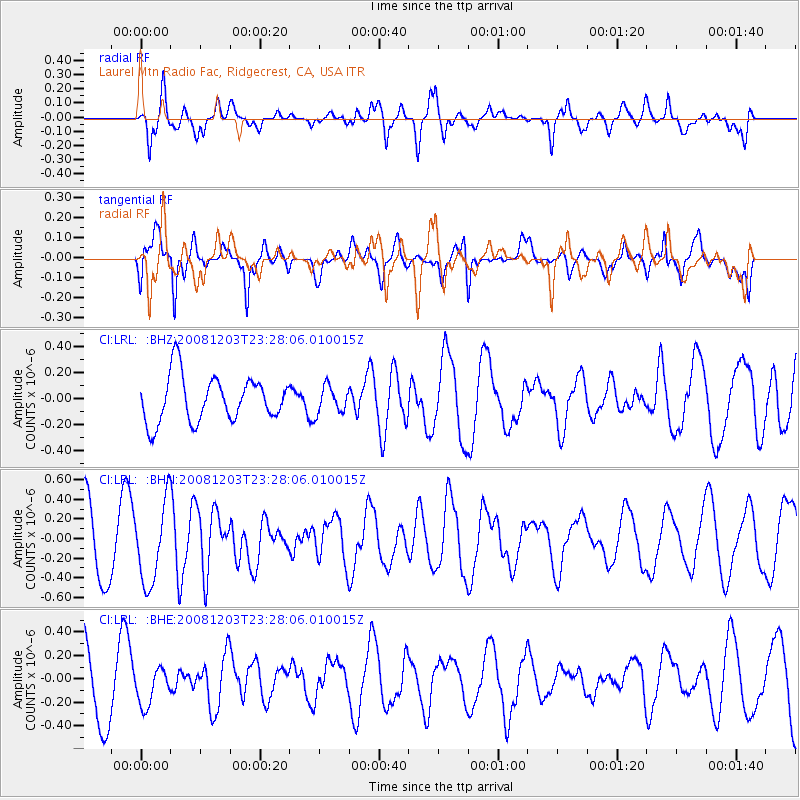
LRL Laurel Mtn Radio Fac, Ridgecrest, CA, USA - Earthquake Result Viewer
*The percent match for this event was below the threshold and hence no stack was calculated.
| Earthquake location: |
Near East Coast Of Honshu, Japan |
| Earthquake latitude/longitude: |
38.6/142.9 |
| Earthquake time(UTC): |
2008/12/03 (338) 23:16:54 GMT |
| Earthquake Depth: |
14 km |
| Earthquake Magnitude: |
5.6 MB, 5.5 MS, 5.8 MW, 5.8 MW |
| Earthquake Catalog/Contributor: |
WHDF/NEIC |
|
| Network: |
CI Caltech Regional Seismic Network |
| Station: |
LRL Laurel Mtn Radio Fac, Ridgecrest, CA, USA |
| Lat/Lon: |
35.48 N/117.68 W |
| Elevation: |
1340 m |
|
| Distance: |
75.3 deg |
| Az: |
56.347 deg |
| Baz: |
306.938 deg |
| Ray Param: |
$rayparam |
*The percent match for this event was below the threshold and hence was not used in the summary stack. |
|
| Radial Match: |
50.122627 % |
| Radial Bump: |
400 |
| Transverse Match: |
56.20444 % |
| Transverse Bump: |
306 |
| SOD ConfigId: |
2658 |
| Insert Time: |
2010-02-25 20:43:50.347 +0000 |
| GWidth: |
2.5 |
| Max Bumps: |
400 |
| Tol: |
0.001 |
|
Signal To Noise
| Channel | StoN | STA | LTA |
| CI:LRL: :BHN:20081203T23:28:06.010015Z | 1.50568 | 4.1176787E-7 | 2.7347636E-7 |
| CI:LRL: :BHE:20081203T23:28:06.010015Z | 0.32983235 | 1.5349943E-7 | 4.6538622E-7 |
| CI:LRL: :BHZ:20081203T23:28:06.010015Z | 0.58898336 | 1.0345021E-7 | 1.75642E-7 |
| Arrivals |
| Ps | |
| PpPs | |
| PsPs/PpSs | |


