You are here: Home > Network List > IU - Global Seismograph Network (GSN - IRIS/USGS) Stations List
> Station RSSD Black Hills, South Dakota, USA > Earthquake Result Viewer
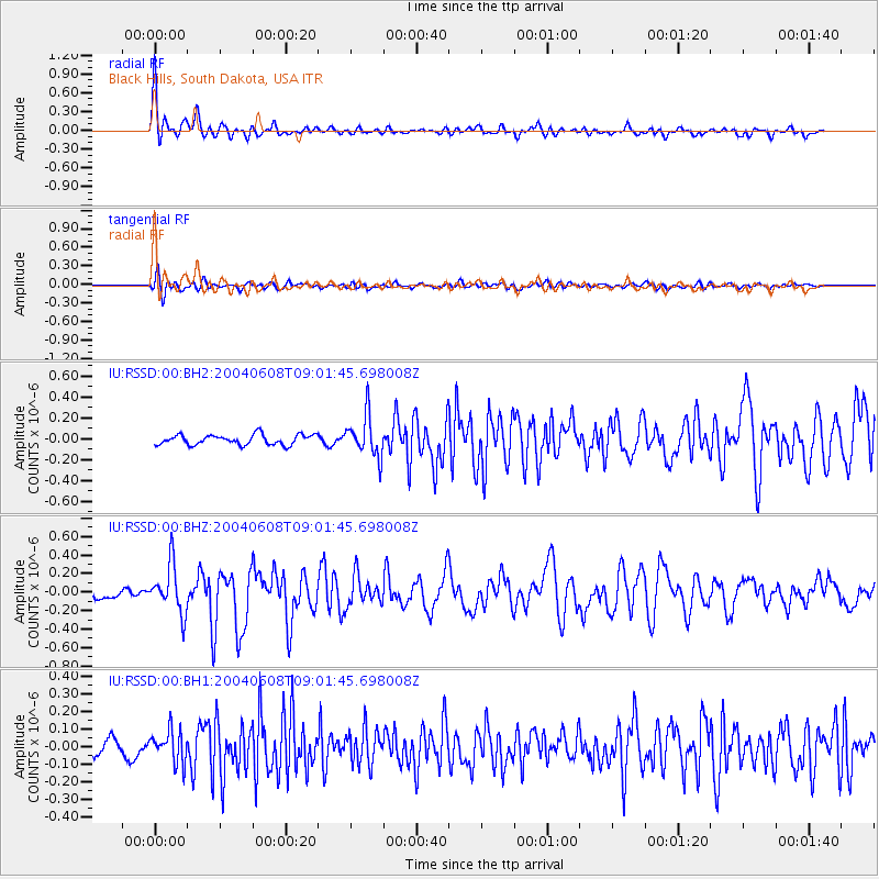
RSSD Black Hills, South Dakota, USA - Earthquake Result Viewer
*The percent match for this event was below the threshold and hence no stack was calculated.
| Earthquake location: |
Caribbean Sea |
| Earthquake latitude/longitude: |
17.5/-83.5 |
| Earthquake time(UTC): |
2004/06/08 (160) 08:55:52 GMT |
| Earthquake Depth: |
10 km |
| Earthquake Magnitude: |
5.2 MB, 5.2 MS, 5.9 MW, 5.8 MW |
| Earthquake Catalog/Contributor: |
WHDF/NEIC |
|
| Network: |
IU Global Seismograph Network (GSN - IRIS/USGS) |
| Station: |
RSSD Black Hills, South Dakota, USA |
| Lat/Lon: |
44.12 N/104.04 W |
| Elevation: |
2060 m |
|
| Distance: |
31.7 deg |
| Az: |
331.196 deg |
| Baz: |
140.328 deg |
| Ray Param: |
$rayparam |
*The percent match for this event was below the threshold and hence was not used in the summary stack. |
|
| Radial Match: |
78.31504 % |
| Radial Bump: |
400 |
| Transverse Match: |
68.71224 % |
| Transverse Bump: |
400 |
| SOD ConfigId: |
590571 |
| Insert Time: |
2013-09-25 06:09:56.097 +0000 |
| GWidth: |
2.5 |
| Max Bumps: |
400 |
| Tol: |
0.001 |
|
Signal To Noise
| Channel | StoN | STA | LTA |
| IU:RSSD:00:BHZ:20040608T09:01:45.698008Z | 3.8422463 | 2.605219E-7 | 6.780458E-8 |
| IU:RSSD:00:BH1:20040608T09:01:45.698008Z | 2.5537016 | 9.3118224E-8 | 3.6464016E-8 |
| IU:RSSD:00:BH2:20040608T09:01:45.698008Z | 4.138718 | 1.9970419E-7 | 4.8252666E-8 |
| Arrivals |
| Ps | |
| PpPs | |
| PsPs/PpSs | |


