You are here: Home > Network List > IU - Global Seismograph Network (GSN - IRIS/USGS) Stations List
> Station POHA Pohakuloa, Hawaii, USA > Earthquake Result Viewer
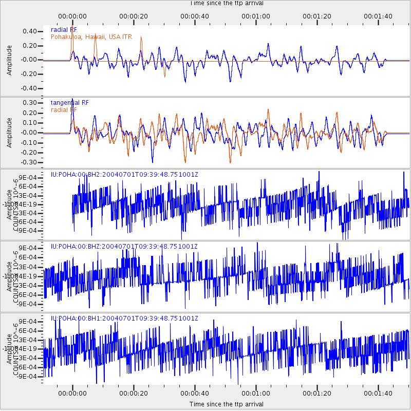
POHA Pohakuloa, Hawaii, USA - Earthquake Result Viewer
*The percent match for this event was below the threshold and hence no stack was calculated.
| Earthquake location: |
Tonga Islands Region |
| Earthquake latitude/longitude: |
-23.1/-175.4 |
| Earthquake time(UTC): |
2004/07/01 (183) 09:31:50 GMT |
| Earthquake Depth: |
10 km |
| Earthquake Magnitude: |
5.6 MW |
| Earthquake Catalog/Contributor: |
NEIC PDE/NEIC PDE-M |
|
| Network: |
IU Global Seismograph Network (GSN - IRIS/USGS) |
| Station: |
POHA Pohakuloa, Hawaii, USA |
| Lat/Lon: |
19.76 N/155.53 W |
| Elevation: |
1967 m |
|
| Distance: |
46.8 deg |
| Az: |
26.075 deg |
| Baz: |
205.454 deg |
| Ray Param: |
$rayparam |
*The percent match for this event was below the threshold and hence was not used in the summary stack. |
|
| Radial Match: |
48.970695 % |
| Radial Bump: |
400 |
| Transverse Match: |
58.607838 % |
| Transverse Bump: |
400 |
| SOD ConfigId: |
590571 |
| Insert Time: |
2013-09-25 06:21:59.373 +0000 |
| GWidth: |
2.5 |
| Max Bumps: |
400 |
| Tol: |
0.001 |
|
Signal To Noise
| Channel | StoN | STA | LTA |
| IU:POHA:00:BHZ:20040701T09:39:48.751001Z | 1.1623089 | 3.945855E-10 | 3.394842E-10 |
| IU:POHA:00:BH1:20040701T09:39:48.751001Z | 1.1451424 | 4.0699252E-10 | 3.554078E-10 |
| IU:POHA:00:BH2:20040701T09:39:48.751001Z | 1.0613286 | 3.7704284E-10 | 3.552555E-10 |
| Arrivals |
| Ps | |
| PpPs | |
| PsPs/PpSs | |


