You are here: Home > Network List > IU - Global Seismograph Network (GSN - IRIS/USGS) Stations List
> Station RSSD Black Hills, South Dakota, USA > Earthquake Result Viewer
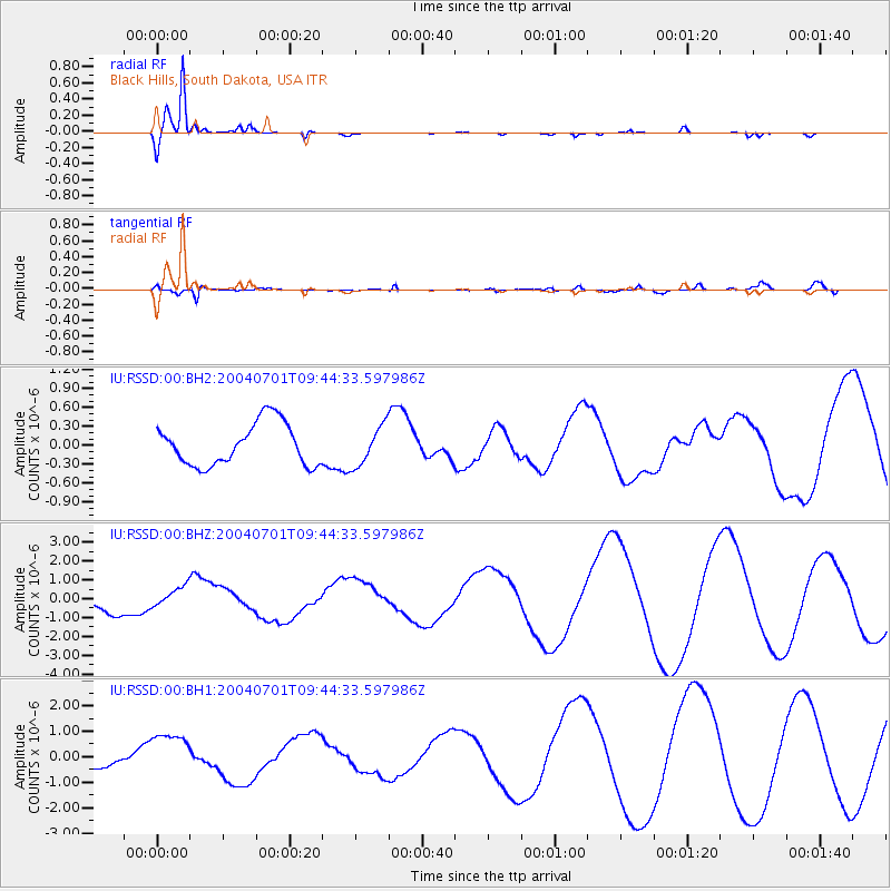
RSSD Black Hills, South Dakota, USA - Earthquake Result Viewer
*The percent match for this event was below the threshold and hence no stack was calculated.
| Earthquake location: |
Tonga Islands Region |
| Earthquake latitude/longitude: |
-23.1/-175.4 |
| Earthquake time(UTC): |
2004/07/01 (183) 09:31:50 GMT |
| Earthquake Depth: |
10 km |
| Earthquake Magnitude: |
5.6 MW |
| Earthquake Catalog/Contributor: |
NEIC PDE/NEIC PDE-M |
|
| Network: |
IU Global Seismograph Network (GSN - IRIS/USGS) |
| Station: |
RSSD Black Hills, South Dakota, USA |
| Lat/Lon: |
44.12 N/104.04 W |
| Elevation: |
2060 m |
|
| Distance: |
93.4 deg |
| Az: |
43.132 deg |
| Baz: |
240.956 deg |
| Ray Param: |
$rayparam |
*The percent match for this event was below the threshold and hence was not used in the summary stack. |
|
| Radial Match: |
97.979836 % |
| Radial Bump: |
262 |
| Transverse Match: |
54.640465 % |
| Transverse Bump: |
400 |
| SOD ConfigId: |
590571 |
| Insert Time: |
2013-09-25 06:22:01.529 +0000 |
| GWidth: |
2.5 |
| Max Bumps: |
400 |
| Tol: |
0.001 |
|
Signal To Noise
| Channel | StoN | STA | LTA |
| IU:RSSD:00:BHZ:20040701T09:44:33.597986Z | 1.1064876 | 5.4114673E-7 | 4.8906713E-7 |
| IU:RSSD:00:BH1:20040701T09:44:33.597986Z | 2.7718973 | 8.763584E-7 | 3.1615832E-7 |
| IU:RSSD:00:BH2:20040701T09:44:33.597986Z | 0.939076 | 3.1294107E-7 | 3.332436E-7 |
| Arrivals |
| Ps | |
| PpPs | |
| PsPs/PpSs | |


