You are here: Home > Network List > IU - Global Seismograph Network (GSN - IRIS/USGS) Stations List
> Station RSSD Black Hills, South Dakota, USA > Earthquake Result Viewer
RSSD Black Hills, South Dakota, USA - Earthquake Result Viewer
*The percent match for this event was below the threshold and hence no stack was calculated.
| Earthquake location: |
Austria |
| Earthquake latitude/longitude: |
46.3/13.6 |
| Earthquake time(UTC): |
2004/07/12 (194) 13:04:07 GMT |
| Earthquake Depth: |
7.7 km |
| Earthquake Magnitude: |
5.7 ML |
| Earthquake Catalog/Contributor: |
NEIC PDE/NEIC PDE-M |
|
| Network: |
IU Global Seismograph Network (GSN - IRIS/USGS) |
| Station: |
RSSD Black Hills, South Dakota, USA |
| Lat/Lon: |
44.12 N/104.04 W |
| Elevation: |
2060 m |
|
| Distance: |
74.5 deg |
| Az: |
318.546 deg |
| Baz: |
39.593 deg |
| Ray Param: |
$rayparam |
*The percent match for this event was below the threshold and hence was not used in the summary stack. |
|
| Radial Match: |
65.171844 % |
| Radial Bump: |
400 |
| Transverse Match: |
46.68253 % |
| Transverse Bump: |
400 |
| SOD ConfigId: |
590571 |
| Insert Time: |
2013-09-25 06:27:55.204 +0000 |
| GWidth: |
2.5 |
| Max Bumps: |
400 |
| Tol: |
0.001 |
|
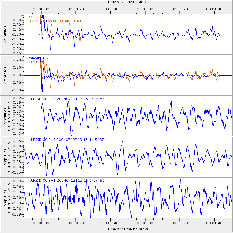
Signal To Noise
| Channel | StoN | STA | LTA |
| IU:RSSD:00:BHZ:20040712T13:15:14.548Z | 2.0036695 | 1.02148825E-7 | 5.0980873E-8 |
| IU:RSSD:00:BH1:20040712T13:15:14.548Z | 1.034448 | 4.3493586E-8 | 4.2045208E-8 |
| IU:RSSD:00:BH2:20040712T13:15:14.548Z | 0.75382227 | 3.7287474E-8 | 4.9464546E-8 |
| Arrivals |
| Ps | |
| PpPs | |
| PsPs/PpSs | |


