WHY Whitehorse, YT - Earthquake Result Viewer
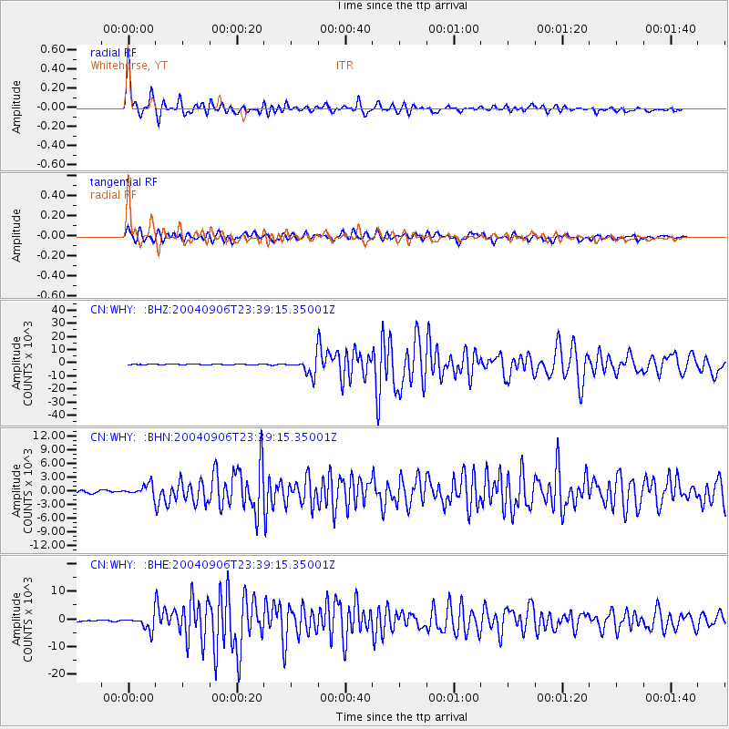
Earthquake location: Near S. Coast Of Honshu, Japan
Earthquake latitude/longitude: 33.2/137.2
Earthquake time(UTC): 2004/09/06 (250) 23:29:35 GMT
Earthquake Depth: 10 km
Earthquake Magnitude: 6.4 MB, 6.3 MS, 6.7 MW, 6.5 MW
Earthquake Catalog/Contributor: WHDF/NEIC
Network: CN Canadian National Seismograph Network
Station: WHY Whitehorse, YT
Lat/Lon: 60.66 N/134.88 W
Elevation: 1292 m
Distance: 60.7 deg
Az: 34.363 deg
Baz: 286.086 deg
Ray Param: 0.061366923
Estimated Moho Depth: 10.75 km
Estimated Crust Vp/Vs: 1.77
Assumed Crust Vp: 6.419 km/s
Estimated Crust Vs: 3.632 km/s
Estimated Crust Poisson's Ratio: 0.26
Radial Match: 95.33765 %
Radial Bump: 400
Transverse Match: 89.30523 %
Transverse Bump: 400
SOD ConfigId: 2459
Insert Time: 2010-02-27 07:46:48.294 +0000
GWidth: 2.5
Max Bumps: 400
Tol: 0.001

Signal To Noise

ChannelStoNSTALTA
CN:WHY: :BHN:20040906T23:39:15.35001Z4.26541761251.9479293.51123
CN:WHY: :BHE:20040906T23:39:15.35001Z9.5939842585.9658269.54037
CN:WHY: :BHZ:20040906T23:39:15.35001Z23.5116466504.7085276.659
Arrivals
Ps1.3 SECOND
PpPs4.4 SECOND
PsPs/PpSs5.8 SECOND