You are here: Home > Network List > IU - Global Seismograph Network (GSN - IRIS/USGS) Stations List
> Station RSSD Black Hills, South Dakota, USA > Earthquake Result Viewer
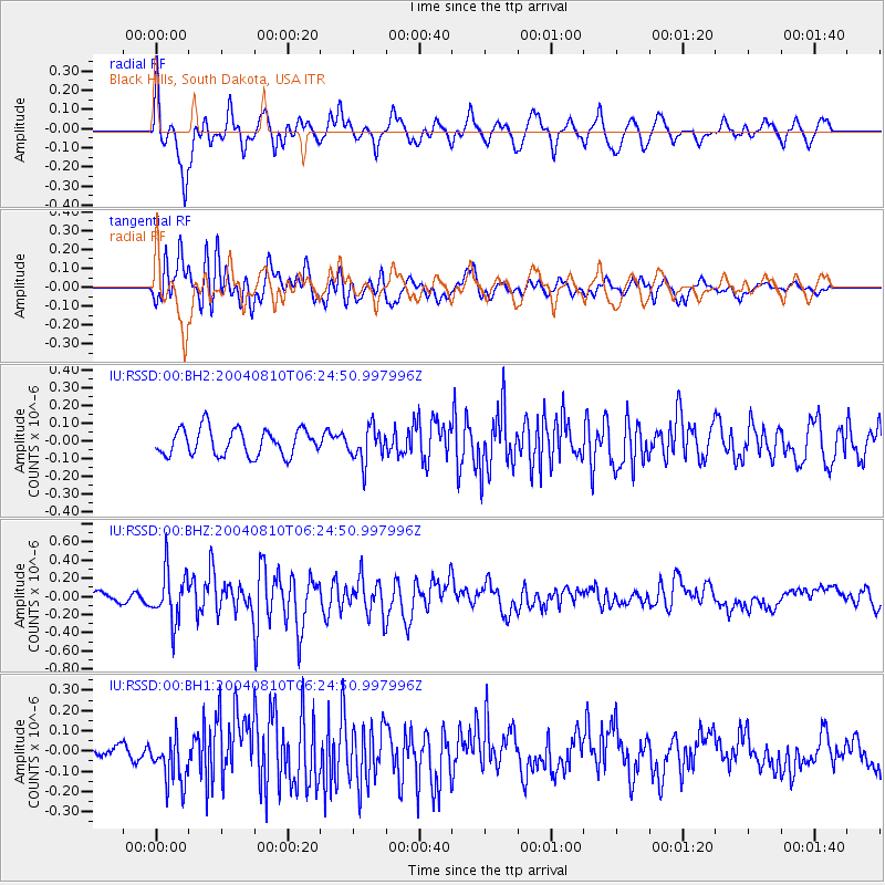
RSSD Black Hills, South Dakota, USA - Earthquake Result Viewer
*The percent match for this event was below the threshold and hence no stack was calculated.
| Earthquake location: |
Eastern Honshu, Japan |
| Earthquake latitude/longitude: |
39.6/142.0 |
| Earthquake time(UTC): |
2004/08/10 (223) 06:13:33 GMT |
| Earthquake Depth: |
70 km |
| Earthquake Magnitude: |
5.7 MW, 5.7 MW, 5.7 MB |
| Earthquake Catalog/Contributor: |
NEIC PDE/NEIC PDE-M |
|
| Network: |
IU Global Seismograph Network (GSN - IRIS/USGS) |
| Station: |
RSSD Black Hills, South Dakota, USA |
| Lat/Lon: |
44.12 N/104.04 W |
| Elevation: |
2060 m |
|
| Distance: |
77.6 deg |
| Az: |
42.344 deg |
| Baz: |
313.76 deg |
| Ray Param: |
$rayparam |
*The percent match for this event was below the threshold and hence was not used in the summary stack. |
|
| Radial Match: |
67.61864 % |
| Radial Bump: |
400 |
| Transverse Match: |
71.82492 % |
| Transverse Bump: |
400 |
| SOD ConfigId: |
590571 |
| Insert Time: |
2013-09-25 06:45:19.348 +0000 |
| GWidth: |
2.5 |
| Max Bumps: |
400 |
| Tol: |
0.001 |
|
Signal To Noise
| Channel | StoN | STA | LTA |
| IU:RSSD:00:BHZ:20040810T06:24:50.997996Z | 5.180007 | 2.745367E-7 | 5.299929E-8 |
| IU:RSSD:00:BH1:20040810T06:24:50.997996Z | 2.1732 | 1.17317754E-7 | 5.3983875E-8 |
| IU:RSSD:00:BH2:20040810T06:24:50.997996Z | 1.3187461 | 9.8587556E-8 | 7.475856E-8 |
| Arrivals |
| Ps | |
| PpPs | |
| PsPs/PpSs | |


