You are here: Home > Network List > IU - Global Seismograph Network (GSN - IRIS/USGS) Stations List
> Station RSSD Black Hills, South Dakota, USA > Earthquake Result Viewer
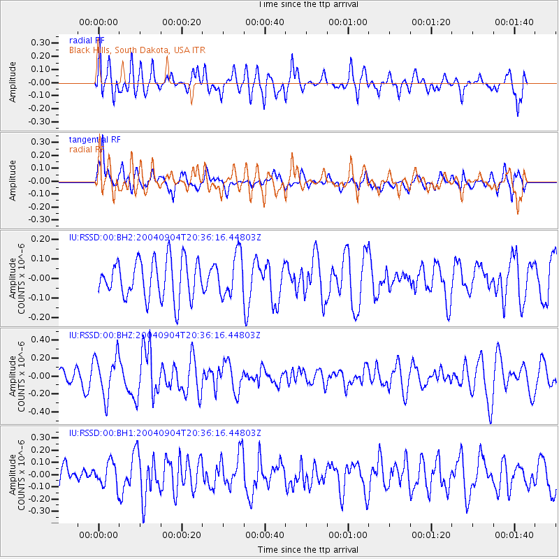
RSSD Black Hills, South Dakota, USA - Earthquake Result Viewer
*The percent match for this event was below the threshold and hence no stack was calculated.
| Earthquake location: |
Samoa Islands Region |
| Earthquake latitude/longitude: |
-14.8/-173.2 |
| Earthquake time(UTC): |
2004/09/04 (248) 20:24:07 GMT |
| Earthquake Depth: |
10 km |
| Earthquake Magnitude: |
5.3 MB, 5.3 MS, 5.7 MW, 5.6 MW |
| Earthquake Catalog/Contributor: |
WHDF/NEIC |
|
| Network: |
IU Global Seismograph Network (GSN - IRIS/USGS) |
| Station: |
RSSD Black Hills, South Dakota, USA |
| Lat/Lon: |
44.12 N/104.04 W |
| Elevation: |
2060 m |
|
| Distance: |
85.9 deg |
| Az: |
42.454 deg |
| Baz: |
245.013 deg |
| Ray Param: |
$rayparam |
*The percent match for this event was below the threshold and hence was not used in the summary stack. |
|
| Radial Match: |
54.630146 % |
| Radial Bump: |
400 |
| Transverse Match: |
62.02993 % |
| Transverse Bump: |
400 |
| SOD ConfigId: |
590571 |
| Insert Time: |
2013-09-25 06:56:56.646 +0000 |
| GWidth: |
2.5 |
| Max Bumps: |
400 |
| Tol: |
0.001 |
|
Signal To Noise
| Channel | StoN | STA | LTA |
| IU:RSSD:00:BHZ:20040904T20:36:16.44803Z | 1.9058585 | 2.3389913E-7 | 1.2272639E-7 |
| IU:RSSD:00:BH1:20040904T20:36:16.44803Z | 0.88649327 | 1.0049421E-7 | 1.1336151E-7 |
| IU:RSSD:00:BH2:20040904T20:36:16.44803Z | 1.1200377 | 1.10556876E-7 | 9.870818E-8 |
| Arrivals |
| Ps | |
| PpPs | |
| PsPs/PpSs | |


