
RSSD Black Hills, South Dakota, USA - Earthquake Result Viewer
| ||||||||||||||||||
| ||||||||||||||||||
| ||||||||||||||||||
|
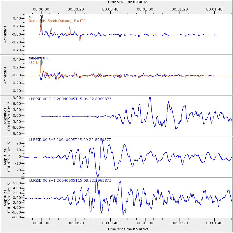
Signal To Noise
| Channel | StoN | STA | LTA |
| IU:RSSD:00:BHZ:20040905T15:09:22.896987Z | 3.6007757 | 4.333552E-7 | 1.203505E-7 |
| IU:RSSD:00:BH1:20040905T15:09:22.896987Z | 1.1261227 | 1.07973214E-7 | 9.58805E-8 |
| IU:RSSD:00:BH2:20040905T15:09:22.896987Z | 2.1891847 | 2.0628191E-7 | 9.422774E-8 |
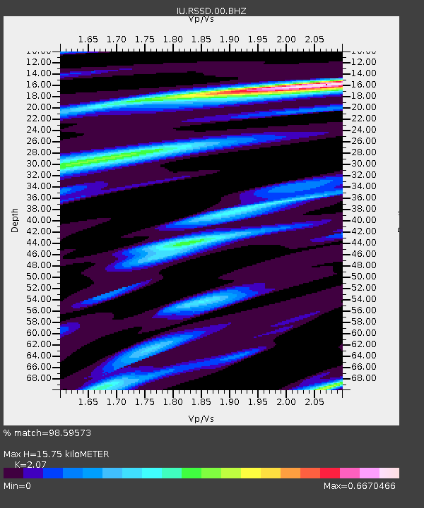
| Arrivals | |
| Ps | 2.8 SECOND |
| PpPs | 7.6 SECOND |
| PsPs/PpSs | 10 SECOND |

