RSSD Black Hills, South Dakota, USA - Earthquake Result Viewer
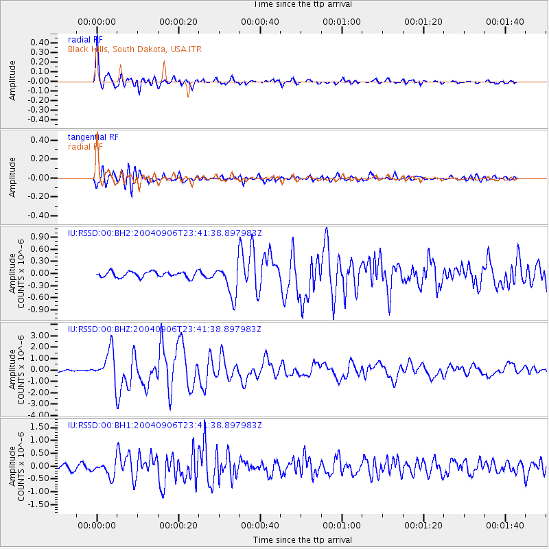
Earthquake location: Near S. Coast Of Honshu, Japan
Earthquake latitude/longitude: 33.2/137.2
Earthquake time(UTC): 2004/09/06 (250) 23:29:35 GMT
Earthquake Depth: 10 km
Earthquake Magnitude: 6.4 MB, 6.3 MS, 6.7 MW, 6.5 MW
Earthquake Catalog/Contributor: WHDF/NEIC
Network: IU Global Seismograph Network (GSN - IRIS/USGS)
Station: RSSD Black Hills, South Dakota, USA
Lat/Lon: 44.12 N/104.04 W
Elevation: 2060 m
Distance: 85.0 deg
Az: 39.343 deg
Baz: 312.44 deg
Ray Param: 0.045107
Estimated Moho Depth: 15.75 km
Estimated Crust Vp/Vs: 2.10
Assumed Crust Vp: 6.242 km/s
Estimated Crust Vs: 2.976 km/s
Estimated Crust Poisson's Ratio: 0.35
Radial Match: 96.57064 %
Radial Bump: 400
Transverse Match: 80.80167 %
Transverse Bump: 400
SOD ConfigId: 590571
Insert Time: 2013-09-25 07:03:19.651 +0000
GWidth: 2.5
Max Bumps: 400
Tol: 0.001

Signal To Noise

ChannelStoNSTALTA
IU:RSSD:00:BHZ:20040906T23:41:38.897983Z26.8214631.4354559E-65.3518928E-8
IU:RSSD:00:BH1:20040906T23:41:38.897983Z2.56699822.9304823E-71.1415989E-7
IU:RSSD:00:BH2:20040906T23:41:38.897983Z6.00447234.2145624E-77.019038E-8
Arrivals
Ps2.8 SECOND
PpPs7.7 SECOND
PsPs/PpSs10 SECOND