You are here: Home > Network List > IU - Global Seismograph Network (GSN - IRIS/USGS) Stations List
> Station RSSD Black Hills, South Dakota, USA > Earthquake Result Viewer
RSSD Black Hills, South Dakota, USA - Earthquake Result Viewer
*The percent match for this event was below the threshold and hence no stack was calculated.
| Earthquake location: |
Near S. Coast Of Honshu, Japan |
| Earthquake latitude/longitude: |
33.2/137.1 |
| Earthquake time(UTC): |
2004/09/07 (251) 18:36:20 GMT |
| Earthquake Depth: |
10 km |
| Earthquake Magnitude: |
5.5 MW, 5.6 MW |
| Earthquake Catalog/Contributor: |
NEIC PDE/NEIC PDE-M |
|
| Network: |
IU Global Seismograph Network (GSN - IRIS/USGS) |
| Station: |
RSSD Black Hills, South Dakota, USA |
| Lat/Lon: |
44.12 N/104.04 W |
| Elevation: |
2060 m |
|
| Distance: |
85.0 deg |
| Az: |
39.279 deg |
| Baz: |
312.548 deg |
| Ray Param: |
$rayparam |
*The percent match for this event was below the threshold and hence was not used in the summary stack. |
|
| Radial Match: |
56.651836 % |
| Radial Bump: |
372 |
| Transverse Match: |
48.57671 % |
| Transverse Bump: |
400 |
| SOD ConfigId: |
590571 |
| Insert Time: |
2013-09-25 07:05:19.902 +0000 |
| GWidth: |
2.5 |
| Max Bumps: |
400 |
| Tol: |
0.001 |
|
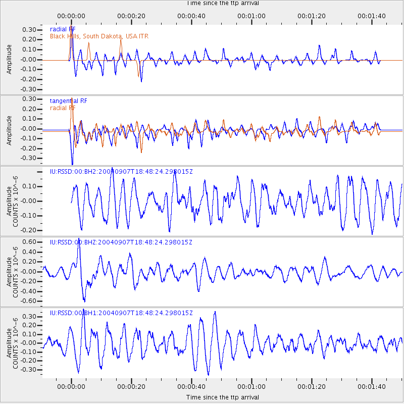
Signal To Noise
| Channel | StoN | STA | LTA |
| IU:RSSD:00:BHZ:20040907T18:48:24.298015Z | 3.8728602 | 3.4618006E-7 | 8.938615E-8 |
| IU:RSSD:00:BH1:20040907T18:48:24.298015Z | 2.7171032 | 2.0636462E-7 | 7.5950226E-8 |
| IU:RSSD:00:BH2:20040907T18:48:24.298015Z | 1.0751618 | 1.1001498E-7 | 1.02324115E-7 |
| Arrivals |
| Ps | |
| PpPs | |
| PsPs/PpSs | |


