You are here: Home > Network List > TA - USArray Transportable Network (new EarthScope stations) Stations List
> Station A04D Lummi Island, WA, USA > Earthquake Result Viewer
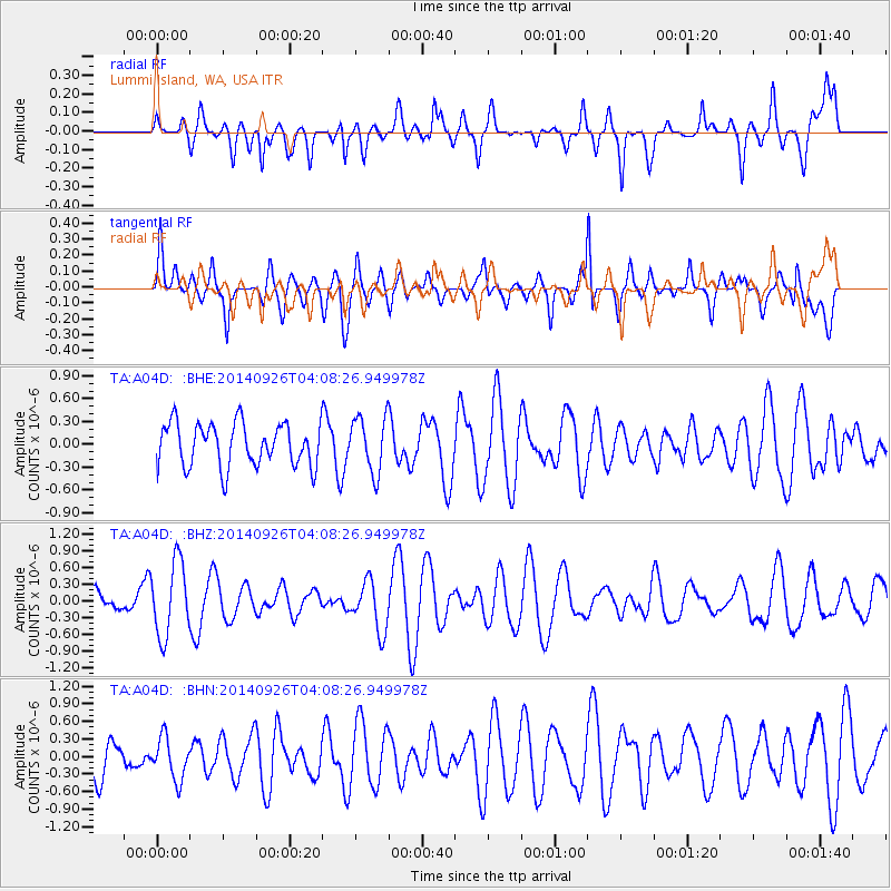
A04D Lummi Island, WA, USA - Earthquake Result Viewer
*The percent match for this event was below the threshold and hence no stack was calculated.
| Earthquake location: |
Eastern New Guinea Reg., P.N.G. |
| Earthquake latitude/longitude: |
-6.6/146.8 |
| Earthquake time(UTC): |
2014/09/26 (269) 03:55:39 GMT |
| Earthquake Depth: |
49 km |
| Earthquake Magnitude: |
5.3 MW |
| Earthquake Catalog/Contributor: |
ISC/ISC |
|
| Network: |
TA USArray Transportable Network (new EarthScope stations) |
| Station: |
A04D Lummi Island, WA, USA |
| Lat/Lon: |
48.72 N/122.71 W |
| Elevation: |
13 m |
|
| Distance: |
95.2 deg |
| Az: |
41.681 deg |
| Baz: |
266.004 deg |
| Ray Param: |
$rayparam |
*The percent match for this event was below the threshold and hence was not used in the summary stack. |
|
| Radial Match: |
52.872837 % |
| Radial Bump: |
400 |
| Transverse Match: |
49.29967 % |
| Transverse Bump: |
400 |
| SOD ConfigId: |
3390531 |
| Insert Time: |
2019-04-14 05:45:14.726 +0000 |
| GWidth: |
2.5 |
| Max Bumps: |
400 |
| Tol: |
0.001 |
|
Signal To Noise
| Channel | StoN | STA | LTA |
| TA:A04D: :BHZ:20140926T04:08:26.949978Z | 1.8184755 | 6.643394E-7 | 3.6532765E-7 |
| TA:A04D: :BHN:20140926T04:08:26.949978Z | 0.9600558 | 3.5364673E-7 | 3.6836062E-7 |
| TA:A04D: :BHE:20140926T04:08:26.949978Z | 1.2856698 | 3.637082E-7 | 2.8289398E-7 |
| Arrivals |
| Ps | |
| PpPs | |
| PsPs/PpSs | |


