You are here: Home > Network List > IU - Global Seismograph Network (GSN - IRIS/USGS) Stations List
> Station RSSD Black Hills, South Dakota, USA > Earthquake Result Viewer
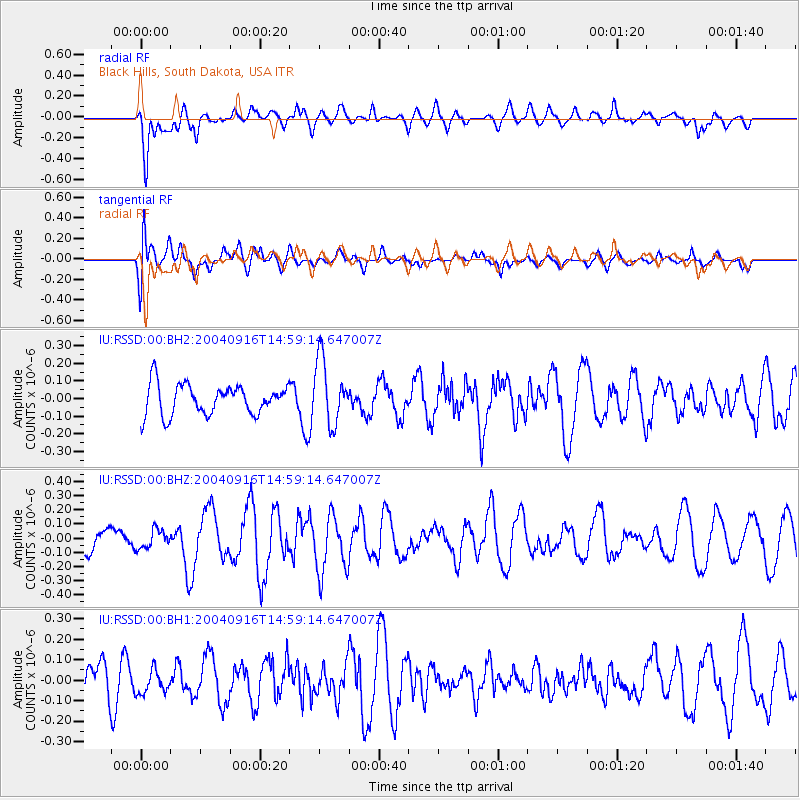
RSSD Black Hills, South Dakota, USA - Earthquake Result Viewer
*The percent match for this event was below the threshold and hence no stack was calculated.
| Earthquake location: |
Near Coast Of Peru |
| Earthquake latitude/longitude: |
-17.3/-72.5 |
| Earthquake time(UTC): |
2004/09/16 (260) 14:48:51 GMT |
| Earthquake Depth: |
28 km |
| Earthquake Magnitude: |
5.5 MB |
| Earthquake Catalog/Contributor: |
NEIC PDE/NEIC PDE-M |
|
| Network: |
IU Global Seismograph Network (GSN - IRIS/USGS) |
| Station: |
RSSD Black Hills, South Dakota, USA |
| Lat/Lon: |
44.12 N/104.04 W |
| Elevation: |
2060 m |
|
| Distance: |
67.6 deg |
| Az: |
335.941 deg |
| Baz: |
147.26 deg |
| Ray Param: |
$rayparam |
*The percent match for this event was below the threshold and hence was not used in the summary stack. |
|
| Radial Match: |
61.482483 % |
| Radial Bump: |
400 |
| Transverse Match: |
59.436115 % |
| Transverse Bump: |
400 |
| SOD ConfigId: |
590571 |
| Insert Time: |
2013-09-25 07:12:24.111 +0000 |
| GWidth: |
2.5 |
| Max Bumps: |
400 |
| Tol: |
0.001 |
|
Signal To Noise
| Channel | StoN | STA | LTA |
| IU:RSSD:00:BHZ:20040916T14:59:14.647007Z | 0.6354795 | 6.5557785E-8 | 1.03162705E-7 |
| IU:RSSD:00:BH1:20040916T14:59:14.647007Z | 0.50830775 | 5.7046293E-8 | 1.1222786E-7 |
| IU:RSSD:00:BH2:20040916T14:59:14.647007Z | 2.1334438 | 1.8297928E-7 | 8.576709E-8 |
| Arrivals |
| Ps | |
| PpPs | |
| PsPs/PpSs | |


