
WHY Whitehorse, YT - Earthquake Result Viewer
| ||||||||||||||||||
| ||||||||||||||||||
| ||||||||||||||||||
|
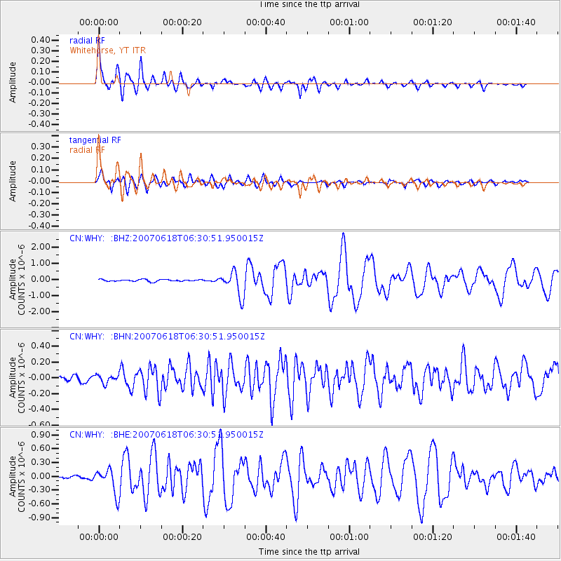
Signal To Noise
| Channel | StoN | STA | LTA |
| CN:WHY: :BHN:20070618T06:30:51.950015Z | 0.8817253 | 5.0811305E-8 | 5.7627137E-8 |
| CN:WHY: :BHE:20070618T06:30:51.950015Z | 6.4647183 | 2.8350547E-7 | 4.3854264E-8 |
| CN:WHY: :BHZ:20070618T06:30:51.950015Z | 13.849302 | 7.899455E-7 | 5.703865E-8 |
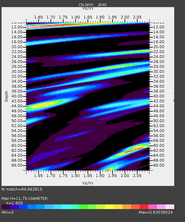
| Arrivals | |
| Ps | 1.1 SECOND |
| PpPs | 4.6 SECOND |
| PsPs/PpSs | 5.8 SECOND |

