EFI Mount Kent, East Falkland Island - Earthquake Result Viewer
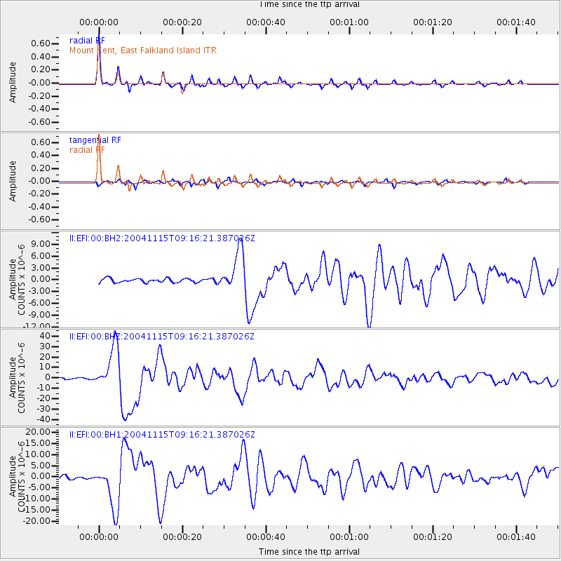
Earthquake location: Near West Coast Of Colombia
Earthquake latitude/longitude: 4.7/-77.5
Earthquake time(UTC): 2004/11/15 (320) 09:06:56 GMT
Earthquake Depth: 15 km
Earthquake Magnitude: 6.6 MB, 7.1 MS, 7.2 MW, 7.1 MW
Earthquake Catalog/Contributor: WHDF/NEIC
Network: II Global Seismograph Network (GSN - IRIS/IDA)
Station: EFI Mount Kent, East Falkland Island
Lat/Lon: 51.68 S/58.06 W
Elevation: 110 m
Distance: 58.6 deg
Az: 165.939 deg
Baz: 337.115 deg
Ray Param: 0.062753186
Estimated Moho Depth: 38.25 km
Estimated Crust Vp/Vs: 1.76
Assumed Crust Vp: 6.472 km/s
Estimated Crust Vs: 3.667 km/s
Estimated Crust Poisson's Ratio: 0.26
Radial Match: 97.50505 %
Radial Bump: 220
Transverse Match: 89.66133 %
Transverse Bump: 400
SOD ConfigId: 590571
Insert Time: 2013-09-25 08:11:55.820 +0000
GWidth: 2.5
Max Bumps: 400
Tol: 0.001

Signal To Noise

ChannelStoNSTALTA
II:EFI:00:BHZ:20041115T09:16:21.387026Z27.136022.1670568E-57.9859046E-7
II:EFI:00:BH1:20041115T09:16:21.387026Z12.3983761.0507723E-58.47508E-7
II:EFI:00:BH2:20041115T09:16:21.387026Z11.1127665.3613235E-64.824472E-7
Arrivals
Ps4.8 SECOND
PpPs16 SECOND
PsPs/PpSs20 SECOND