You are here: Home > Network List > II - Global Seismograph Network (GSN - IRIS/IDA) Stations List
> Station MBAR Mbarara, Uganda > Earthquake Result Viewer
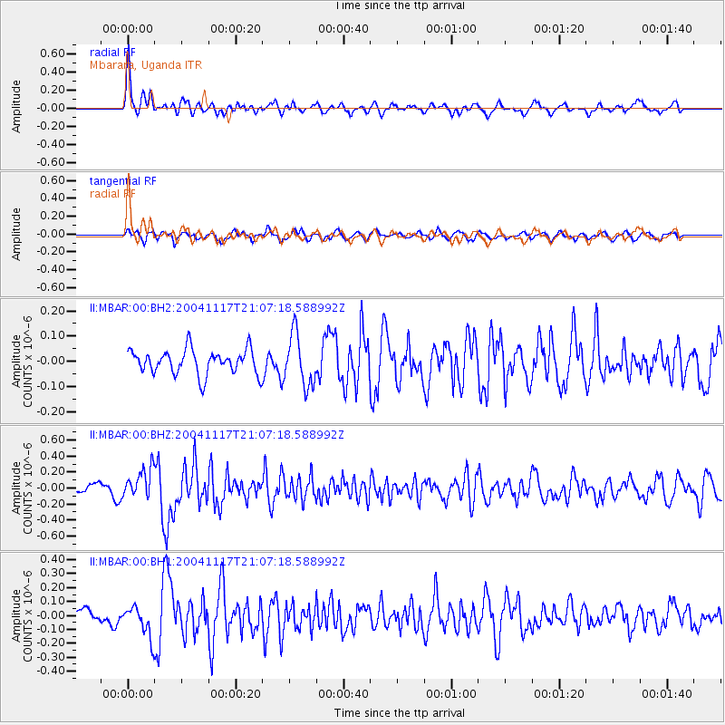
MBAR Mbarara, Uganda - Earthquake Result Viewer
*The percent match for this event was below the threshold and hence no stack was calculated.
| Earthquake location: |
Tajikistan |
| Earthquake latitude/longitude: |
39.2/71.9 |
| Earthquake time(UTC): |
2004/11/17 (322) 20:58:22 GMT |
| Earthquake Depth: |
20 km |
| Earthquake Magnitude: |
5.7 MW, 5.7 MS, 5.8 MW, 5.8 MB |
| Earthquake Catalog/Contributor: |
NEIC PDE/NEIC PDE-M |
|
| Network: |
II Global Seismograph Network (GSN - IRIS/IDA) |
| Station: |
MBAR Mbarara, Uganda |
| Lat/Lon: |
0.60 S/30.74 E |
| Elevation: |
1390 m |
|
| Distance: |
54.6 deg |
| Az: |
233.749 deg |
| Baz: |
38.81 deg |
| Ray Param: |
$rayparam |
*The percent match for this event was below the threshold and hence was not used in the summary stack. |
|
| Radial Match: |
71.49952 % |
| Radial Bump: |
400 |
| Transverse Match: |
60.246277 % |
| Transverse Bump: |
400 |
| SOD ConfigId: |
590571 |
| Insert Time: |
2013-09-25 08:13:48.018 +0000 |
| GWidth: |
2.5 |
| Max Bumps: |
400 |
| Tol: |
0.001 |
|
Signal To Noise
| Channel | StoN | STA | LTA |
| II:MBAR:00:BHZ:20041117T21:07:18.588992Z | 2.6668696 | 1.8660016E-7 | 6.996974E-8 |
| II:MBAR:00:BH1:20041117T21:07:18.588992Z | 2.1661792 | 1.138024E-7 | 5.2536006E-8 |
| II:MBAR:00:BH2:20041117T21:07:18.588992Z | 2.103763 | 1.0314098E-7 | 4.9026898E-8 |
| Arrivals |
| Ps | |
| PpPs | |
| PsPs/PpSs | |


